Distance from Bellevue to Regina
Distance between Bellevue and Regina is 1317 kilometers (818 miles).
Driving distance from Bellevue to Regina is 1662 kilometers (1033 miles).
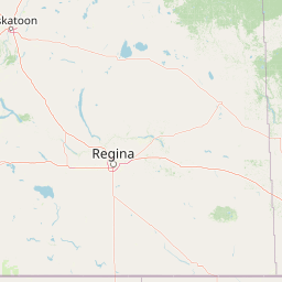
Distance Map Between Bellevue and Regina
Bellevue, Olympia, United States ↔ Regina, Canada = 818 miles = 1317 km.


How far is it between Bellevue and Regina
Bellevue is located in United States with (47.6104,-122.2007) coordinates and Regina is located in Canada with (50.4501,-104.6178) coordinates. The calculated flying distance from Bellevue to Regina is equal to 818 miles which is equal to 1317 km.
If you want to go by car, the driving distance between Bellevue and Regina is 1661.91 km. If you ride your car with an average speed of 112 kilometers/hour (70 miles/h), travel time will be 14 hours 50 minutes. Please check the avg. speed travel time table on the right for various options.
Difference between fly and go by a car is 345 km.
| City/Place | Latitude and Longitude | GPS Coordinates |
|---|---|---|
| Bellevue | 47.6104, -122.2007 | 47° 36´ 37.3680'' N 122° 12´ 2.4480'' W |
| Regina | 50.4501, -104.6178 | 50° 27´ 0.2880'' N 104° 37´ 4.0800'' W |
Estimated Travel Time Between Bellevue and Regina
| Average Speed | Travel Time |
|---|---|
| 30 mph (48 km/h) | 34 hours 37 minutes |
| 40 mph (64 km/h) | 25 hours 58 minutes |
| 50 mph (80 km/h) | 20 hours 46 minutes |
| 60 mph (97 km/h) | 17 hours 07 minutes |
| 70 mph (112 km/h) | 14 hours 50 minutes |
| 75 mph (120 km/h) | 13 hours 50 minutes |
Related Distances from Bellevue
| Cities | Distance |
|---|---|
| Bellevue to Vancouver | 226 km |
| Bellevue to Ontario | 1887 km |
| Bellevue to Saskatoon | 1679 km |
| Bellevue to Okanagan | 570 km |
| Bellevue to Surrey | 193 km |
Related Distances to Regina
| Cities | Distance |
|---|---|
| Fargo to Regina | 825 km |
| Minot to Regina | 392 km |
| Chicago to Regina | 1853 km |
| Seattle to Regina | 1670 km |
| Bismarck to Regina | 566 km |