Distance from Beloit to Markham
Distance between Beloit and Markham is 805 kilometers (500 miles).
Driving distance from Beloit to Markham is 1015 kilometers (631 miles).
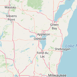
Distance Map Between Beloit and Markham
Beloit, Madison, United States ↔ Markham, Ontario, Canada = 500 miles = 805 km.


How far is it between Beloit and Markham
Beloit is located in United States with (42.5084,-89.0318) coordinates and Markham is located in Canada with (43.8668,-79.2663) coordinates. The calculated flying distance from Beloit to Markham is equal to 500 miles which is equal to 805 km.
If you want to go by car, the driving distance between Beloit and Markham is 1015.33 km. If you ride your car with an average speed of 112 kilometers/hour (70 miles/h), travel time will be 09 hours 03 minutes. Please check the avg. speed travel time table on the right for various options.
Difference between fly and go by a car is 210 km.
| City/Place | Latitude and Longitude | GPS Coordinates |
|---|---|---|
| Beloit | 42.5084, -89.0318 | 42° 30´ 30.0600'' N 89° 1´ 54.4080'' W |
| Markham | 43.8668, -79.2663 | 43° 52´ 0.5520'' N 79° 15´ 58.6800'' W |
Estimated Travel Time Between Beloit and Markham
| Average Speed | Travel Time |
|---|---|
| 30 mph (48 km/h) | 21 hours 09 minutes |
| 40 mph (64 km/h) | 15 hours 51 minutes |
| 50 mph (80 km/h) | 12 hours 41 minutes |
| 60 mph (97 km/h) | 10 hours 28 minutes |
| 70 mph (112 km/h) | 09 hours 03 minutes |
| 75 mph (120 km/h) | 08 hours 27 minutes |
Related Distances from Beloit
| Cities | Distance |
|---|---|
| Beloit to Gatineau | 1440 km |
| Beloit to Hamilton | 935 km |
| Beloit to Kitchener | 909 km |
| Beloit to Laval | 1533 km |
| Beloit to London 2 | 824 km |
| Beloit to Longueuil | 1553 km |
| Beloit to Markham | 1015 km |
| Beloit to Mississauga | 976 km |
| Beloit to Montreal | 1528 km |
| Beloit to North York | 997 km |
Related Distances to Markham
| Cities | Distance |
|---|---|
| Oceanside 2 to Markham | 872 km |
| East Chicago to Markham | 821 km |
| Dolton to Markham | 833 km |
| Wellesley to Markham | 902 km |
| Cranberry Township to Markham | 517 km |
| Rochester to Markham | 308 km |
| Baldwin to Markham | 875 km |
| Round Lake Beach to Markham | 951 km |
| Baldwin 2 to Markham | 560 km |
| Trenton to Markham | 860 km |