Distance from Bende to Libreville
Distance between Bende and Libreville is 609 kilometers (378 miles).
Distance Map Between Bende and Libreville
Bende, Umuahia, Nigeria ↔ Libreville, Gabon = 378 miles = 609 km.


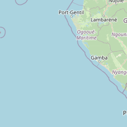


Leaflet | © OpenStreetMap
How far is it between Bende and Libreville
Bende is located in Nigeria with (5.5572,7.6368) coordinates and Libreville is located in Gabon with (0.3924,9.4536) coordinates. The calculated flying distance from Bende to Libreville is equal to 378 miles which is equal to 609 km.
| City/Place | Latitude and Longitude | GPS Coordinates |
|---|---|---|
| Bende | 5.5572, 7.6368 | 5° 33´ 25.8480'' N 7° 38´ 12.3360'' E |
| Libreville | 0.3924, 9.4536 | 0° 23´ 32.6760'' N 9° 27´ 12.8160'' E |
Bende, Umuahia, Nigeria
Related Distances from Bende
| Cities | Distance |
|---|---|
| Bende to Aba | 79 km |
| Bende to Ohafia Ifigh | 24 km |
| Bende to Amaigbo | 43 km |
Libreville, Gabon
Related Distances to Libreville
| Cities | Distance |
|---|---|
| Lagos to Libreville | 1977 km |
| Port Harcourt to Libreville | 1470 km |
| Calabar to Libreville | 1299 km |
| Abuja to Libreville | 1730 km |
| Gombe to Libreville | 1817 km |