Distance from Berlin to Teplice
Distance between Berlin and Teplice is 211 kilometers (131 miles).
Driving distance from Berlin to Teplice is 270 kilometers (168 miles).
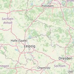
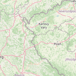
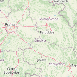
Distance Map Between Berlin and Teplice
Berlin, Germany ↔ Teplice, Usti nad Labem, Czech Republic = 131 miles = 211 km.

How far is it between Berlin and Teplice
Berlin is located in Germany with (52.5244,13.4105) coordinates and Teplice is located in Czech Republic with (50.6404,13.8245) coordinates. The calculated flying distance from Berlin to Teplice is equal to 131 miles which is equal to 211 km.
If you want to go by car, the driving distance between Berlin and Teplice is 270.15 km. If you ride your car with an average speed of 112 kilometers/hour (70 miles/h), travel time will be 02 hours 24 minutes. Please check the avg. speed travel time table on the right for various options.
Difference between fly and go by a car is 59 km.
| City/Place | Latitude and Longitude | GPS Coordinates |
|---|---|---|
| Berlin | 52.5244, 13.4105 | 52° 31´ 27.7320'' N 13° 24´ 37.9080'' E |
| Teplice | 50.6404, 13.8245 | 50° 38´ 25.4400'' N 13° 49´ 28.2360'' E |
Estimated Travel Time Between Berlin and Teplice
| Average Speed | Travel Time |
|---|---|
| 30 mph (48 km/h) | 05 hours 37 minutes |
| 40 mph (64 km/h) | 04 hours 13 minutes |
| 50 mph (80 km/h) | 03 hours 22 minutes |
| 60 mph (97 km/h) | 02 hours 47 minutes |
| 70 mph (112 km/h) | 02 hours 24 minutes |
| 75 mph (120 km/h) | 02 hours 15 minutes |
Related Distances from Berlin
| Cities | Distance |
|---|---|
| Berlin to Benesov | 394 km |
| Berlin to Beroun | 382 km |
| Berlin to Bilina | 290 km |
| Berlin to Bilina Kyselka | 291 km |
| Berlin to Blansko | 580 km |
| Berlin to Bohumin | 552 km |
| Berlin to Brandys Nad Labem Stara Boleslav | 352 km |
| Berlin to Branik | 359 km |
| Berlin to Breclav | 607 km |
| Berlin to Brno | 555 km |
Related Distances to Teplice
| Cities | Distance |
|---|---|
| Berlin to Teplice | 270 km |
| Hamburg to Teplice | 571 km |