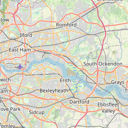
Distance from Bexley to Reading
Distance between Bexley and Reading is 78 kilometers (48 miles).
Driving distance from Bexley to Reading is 133 kilometers (83 miles).
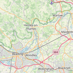
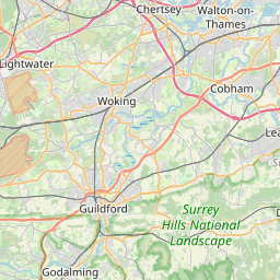
Distance Map Between Bexley and Reading
Bexley, London, United Kingdom ↔ Reading, London, United Kingdom = 48 miles = 78 km.

How far is it between Bexley and Reading
Bexley is located in United Kingdom with (51.4416,0.1487) coordinates and Reading is located in United Kingdom with (51.4563,-0.9711) coordinates. The calculated flying distance from Bexley to Reading is equal to 48 miles which is equal to 78 km.
If you want to go by car, the driving distance between Bexley and Reading is 133.43 km. If you ride your car with an average speed of 112 kilometers/hour (70 miles/h), travel time will be 01 hours 11 minutes. Please check the avg. speed travel time table on the right for various options.
Difference between fly and go by a car is 55 km.
| City/Place | Latitude and Longitude | GPS Coordinates |
|---|---|---|
| Bexley | 51.4416, 0.1487 | 51° 26´ 29.8320'' N 0° 8´ 55.1760'' E |
| Reading | 51.4563, -0.9711 | 51° 27´ 22.5000'' N 0° 58´ 16.0680'' W |
Estimated Travel Time Between Bexley and Reading
| Average Speed | Travel Time |
|---|---|
| 30 mph (48 km/h) | 02 hours 46 minutes |
| 40 mph (64 km/h) | 02 hours 05 minutes |
| 50 mph (80 km/h) | 01 hours 40 minutes |
| 60 mph (97 km/h) | 01 hours 22 minutes |
| 70 mph (112 km/h) | 01 hours 11 minutes |
| 75 mph (120 km/h) | 01 hours 06 minutes |
Related Distances from Bexley
| Cities | Distance |
|---|---|
| Bexley to City Of London | 22 km |
| Bexley to Maidstone | 42 km |
| Bexley to Oxford | 168 km |
| Bexley to Liverpool | 386 km |
| Bexley to Watford | 88 km |
Related Distances to Reading
| Cities | Distance |
|---|---|
| City Of London to Reading | 70 km |
| Oxford to Reading | 42 km |
| Manchester to Reading | 298 km |
| Birmingham to Reading | 169 km |
| Bristol to Reading | 132 km |