Distance from Bhadohi to Mau
Distance between Bhadohi and Mau is 117 kilometers (73 miles).
Driving distance from Bhadohi to Mau is 149 kilometers (92 miles).
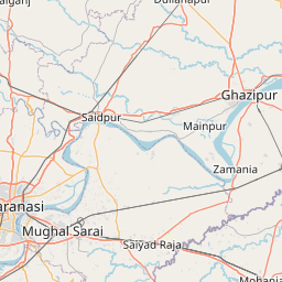
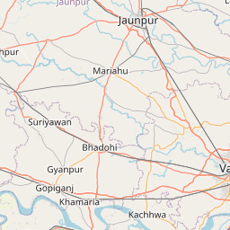
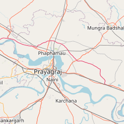
Distance Map Between Bhadohi and Mau
Bhadohi, Lucknow, India ↔ Mau, Lucknow, India = 73 miles = 117 km.


How far is it between Bhadohī and Mau
Bhadohi is located in India with (25.3949,82.5664) coordinates and Mau is located in India with (25.9417,83.5611) coordinates. The calculated flying distance from Bhadohi to Mau is equal to 73 miles which is equal to 117 km.
If you want to go by car, the driving distance between Bhadohi and Mau is 148.65 km. If you ride your car with an average speed of 112 kilometers/hour (70 miles/h), travel time will be 01 hours 19 minutes. Please check the avg. speed travel time table on the right for various options.
Difference between fly and go by a car is 32 km.
| City/Place | Latitude and Longitude | GPS Coordinates |
|---|---|---|
| Bhadohi | 25.3949, 82.5664 | 25° 23´ 41.6400'' N 82° 33´ 58.8960'' E |
| Mau | 25.9417, 83.5611 | 25° 56´ 30.0120'' N 83° 33´ 39.9960'' E |
Estimated Travel Time Between Bhadohī and Mau
| Average Speed | Travel Time |
|---|---|
| 30 mph (48 km/h) | 03 hours 05 minutes |
| 40 mph (64 km/h) | 02 hours 19 minutes |
| 50 mph (80 km/h) | 01 hours 51 minutes |
| 60 mph (97 km/h) | 01 hours 31 minutes |
| 70 mph (112 km/h) | 01 hours 19 minutes |
| 75 mph (120 km/h) | 01 hours 14 minutes |
Related Distances from Bhadohi
| Cities | Distance |
|---|---|
| Bhadohi to Mariahu | 24 km |
| Bhadohi to Mirzapur | 32 km |
| Bhadohi to Handia | 46 km |
| Bhadohi to Machhlishahr | 46 km |
| Bhadohi to Shahganj | 77 km |
Related Distances to Mau
| Cities | Distance |
|---|---|
| Gorakhpur 2 to Mau | 101 km |
| Ghosi to Mau | 19 km |
| Ghazipur to Mau | 45 km |
| Kanpur to Maudaha | 97 km |
| Banda to Maudaha | 53 km |