Distance from Bhadra to Merta
Distance between Bhadra and Merta is 295 kilometers (183 miles).
Driving distance from Bhadra to Merta is 354 kilometers (220 miles).
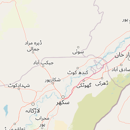
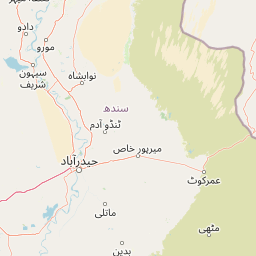
Distance Map Between Bhadra and Merta
Bhadra, Jaipur, India ↔ Merta, Jaipur, India = 183 miles = 295 km.


How far is it between Bhādra and Merta
Bhadra is located in India with (29.103,75.1714) coordinates and Merta is located in India with (26.6486,74.0341) coordinates. The calculated flying distance from Bhadra to Merta is equal to 183 miles which is equal to 295 km.
If you want to go by car, the driving distance between Bhadra and Merta is 353.77 km. If you ride your car with an average speed of 112 kilometers/hour (70 miles/h), travel time will be 03 hours 09 minutes. Please check the avg. speed travel time table on the right for various options.
Difference between fly and go by a car is 59 km.
| City/Place | Latitude and Longitude | GPS Coordinates |
|---|---|---|
| Bhadra | 29.103, 75.1714 | 29° 6´ 10.7280'' N 75° 10´ 16.9680'' E |
| Merta | 26.6486, 74.0341 | 26° 38´ 54.9240'' N 74° 2´ 2.9040'' E |
Estimated Travel Time Between Bhādra and Merta
| Average Speed | Travel Time |
|---|---|
| 30 mph (48 km/h) | 07 hours 22 minutes |
| 40 mph (64 km/h) | 05 hours 31 minutes |
| 50 mph (80 km/h) | 04 hours 25 minutes |
| 60 mph (97 km/h) | 03 hours 38 minutes |
| 70 mph (112 km/h) | 03 hours 09 minutes |
| 75 mph (120 km/h) | 02 hours 56 minutes |
Related Distances from Bhadra
| Cities | Distance |
|---|---|
| Bhadra to Nohar | 48 km |
| Bhadra to Rawatsar | 89 km |
| Bhadra to Taranagar | 79 km |
| Bhadra to Ratangarh | 158 km |
| Bhadra to Rajgarh | 60 km |
Related Distances to Merta
| Cities | Distance |
|---|---|
| Jaitaran to Merta | 57 km |
| Bilara to Merta | 83 km |
| Beawar to Merta | 78 km |
| Jodhpur to Merta | 124 km |
| Kuchera to Merta | 45 km |