Distance from Bilaspur to Dhaka
Distance between Bilaspur and Dhaka is 1250 kilometers (777 miles).
Driving distance from Bilaspur to Dhaka is 1699 kilometers (1056 miles).
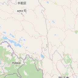
Distance Map Between Bilaspur and Dhaka
Bilaspur, Lucknow, India ↔ Dhaka, Bangladesh = 777 miles = 1250 km.


How far is it between Bilāspur and Dhaka
Bilaspur is located in India with (28.8869,79.2666) coordinates and Dhaka is located in Bangladesh with (23.7104,90.4074) coordinates. The calculated flying distance from Bilaspur to Dhaka is equal to 777 miles which is equal to 1250 km.
If you want to go by car, the driving distance between Bilaspur and Dhaka is 1699.15 km. If you ride your car with an average speed of 112 kilometers/hour (70 miles/h), travel time will be 15 hours 10 minutes. Please check the avg. speed travel time table on the right for various options.
Difference between fly and go by a car is 449 km.
| City/Place | Latitude and Longitude | GPS Coordinates |
|---|---|---|
| Bilaspur | 28.8869, 79.2666 | 28° 53´ 12.8400'' N 79° 15´ 59.8680'' E |
| Dhaka | 23.7104, 90.4074 | 23° 42´ 37.4400'' N 90° 24´ 26.7840'' E |
Estimated Travel Time Between Bilāspur and Dhaka
| Average Speed | Travel Time |
|---|---|
| 30 mph (48 km/h) | 35 hours 23 minutes |
| 40 mph (64 km/h) | 26 hours 32 minutes |
| 50 mph (80 km/h) | 21 hours 14 minutes |
| 60 mph (97 km/h) | 17 hours 31 minutes |
| 70 mph (112 km/h) | 15 hours 10 minutes |
| 75 mph (120 km/h) | 14 hours 09 minutes |
Related Distances from Bilaspur
| Cities | Distance |
|---|---|
| Bilaspur 2 to Chittagong | 1945 km |
| Bilaspur 2 to Dhaka | 1699 km |
| Bilaspur 2 to Khulna | 1486 km |
Related Distances to Dhaka
| Cities | Distance |
|---|---|
| Kultali to Dhaka | 413 km |
| Gwalior to Dhaka | 1585 km |
| Baghdogra to Dhaka | 496 km |
| Kanker to Dhaka | 1248 km |
| Safipur to Dhaka | 1362 km |
| Kolkata to Dhaka | 328 km |
| Danapur to Dhaka | 764 km |
| Shahbazpur to Dhaka | 587 km |
| Mawana to Dhaka | 1783 km |
| Kanpur to Dhaka | 1251 km |