Distance from Bilaspur to Kabul
Distance between Bilaspur and Kabul is 1141 kilometers (709 miles).
Distance Map Between Bilaspur and Kabul
Bilaspur, Lucknow, India ↔ Kabul, Afghanistan = 709 miles = 1141 km.


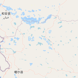


Leaflet | © OpenStreetMap
How far is it between Bilāspur and Kabul
Bilaspur is located in India with (28.8869,79.2666) coordinates and Kabul is located in Afghanistan with (34.5281,69.1723) coordinates. The calculated flying distance from Bilaspur to Kabul is equal to 709 miles which is equal to 1141 km.
| City/Place | Latitude and Longitude | GPS Coordinates |
|---|---|---|
| Bilaspur | 28.8869, 79.2666 | 28° 53´ 12.8400'' N 79° 15´ 59.8680'' E |
| Kabul | 34.5281, 69.1723 | 34° 31´ 41.2680'' N 69° 10´ 20.3880'' E |
Bilaspur, Lucknow, India
Related Distances from Bilaspur
| Cities | Distance |
|---|---|
| Bilaspur 2 to Budaun | 121 km |
| Bilaspur 2 to Bulandshahr | 178 km |
| Bilaspur 2 to Chandausi | 95 km |
| Bilaspur 2 to Chandpur | 129 km |
| Bilaspur 2 to Deoband | 259 km |
| Bilaspur 2 to Deoria | 687 km |
| Bilaspur 2 to Etawah | 321 km |
| Bilaspur 2 to Farrukhabad | 207 km |
| Bilaspur 2 to Fatehpur | 428 km |
| Bilaspur 2 to Firozabad | 269 km |
Kabul, Afghanistan
Related Distances to Kabul
| Cities | Distance |
|---|---|
| Paonta Sahib to Kabul | 5022 km |
| Jaipur to Kabul | 5174 km |
| Kolkata to Kabul | 4877 km |
| Sambhal to Kabul | 4897 km |
| Shahdol to Kabul | 4886 km |
| Anantnag to Kabul | 5906 km |
| Patna to Kabul | 4320 km |
| Ajmer to Kabul | 5304 km |
| Bhopal to Kabul | 5118 km |
| Hugli to Kabul | 4796 km |