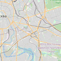
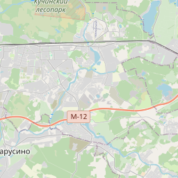
Distance from Biryulevo to Lyublino
Distance between Biryulevo and Lyublino is 11 kilometers (7 miles).
Driving distance from Biryulevo to Lyublino is 20 kilometers (12 miles).
Distance Map Between Biryulevo and Lyublino
Biryulevo, Moscow, Russia ↔ Lyublino, Moscow, Russia = 7 miles = 11 km.


How far is it between Biryulëvo and Lyublino
Biryulevo is located in Russia with (55.5864,37.6778) coordinates and Lyublino is located in Russia with (55.6792,37.7525) coordinates. The calculated flying distance from Biryulevo to Lyublino is equal to 7 miles which is equal to 11 km.
If you want to go by car, the driving distance between Biryulevo and Lyublino is 19.51 km. If you ride your car with an average speed of 112 kilometers/hour (70 miles/h), travel time will be 00 hours 10 minutes. Please check the avg. speed travel time table on the right for various options.
Difference between fly and go by a car is 9 km.
| City/Place | Latitude and Longitude | GPS Coordinates |
|---|---|---|
| Biryulevo | 55.5864, 37.6778 | 55° 35´ 10.8600'' N 37° 40´ 40.1160'' E |
| Lyublino | 55.6792, 37.7525 | 55° 40´ 45.2280'' N 37° 45´ 9.0000'' E |
Estimated Travel Time Between Biryulëvo and Lyublino
| Average Speed | Travel Time |
|---|---|
| 30 mph (48 km/h) | 00 hours 24 minutes |
| 40 mph (64 km/h) | 00 hours 18 minutes |
| 50 mph (80 km/h) | 00 hours 14 minutes |
| 60 mph (97 km/h) | 00 hours 12 minutes |
| 70 mph (112 km/h) | 00 hours 10 minutes |
| 75 mph (120 km/h) | 00 hours 09 minutes |
Related Distances from Biryulevo
| Cities | Distance |
|---|---|
| Biryulevo to Lyublino | 20 km |
| Biryulevo to Rublevo | 38 km |
| Biryulevo to Ryazanskiy | 28 km |
| Biryulevo to Vatutino | 51 km |
| Biryulevo to Tsaritsyno | 5 km |
Related Distances to Lyublino
| Cities | Distance |
|---|---|
| Biryulevo to Lyublino | 20 km |
| Brateyevo to Lyublino | 7 km |
| Bibirevo to Lyublino | 45 km |
| Orekhovo Borisovo to Lyublino | 10 km |
| Lianozovo to Lyublino | 46 km |