Distance from Bocholt to Hurth
Distance between Bocholt and Hurth is 109 kilometers (68 miles).
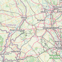
Distance Map Between Bocholt and Hurth
Bocholt, Dusseldorf, Germany ↔ Hurth, Dusseldorf, Germany = 68 miles = 109 km.


Leaflet | © OpenStreetMap
How far is it between Bocholt and Hürth
Bocholt is located in Germany with (51.8388,6.6153) coordinates and Hurth is located in Germany with (50.8708,6.8676) coordinates. The calculated flying distance from Bocholt to Hurth is equal to 68 miles which is equal to 109 km.
| City/Place | Latitude and Longitude | GPS Coordinates |
|---|---|---|
| Bocholt | 51.8388, 6.6153 | 51° 50´ 19.6440'' N 6° 36´ 55.1160'' E |
| Hurth | 50.8708, 6.8676 | 50° 52´ 14.8440'' N 6° 52´ 3.3960'' E |
Bocholt, Dusseldorf, Germany
Related Distances from Bocholt
| Cities | Distance |
|---|---|
| Bocholt to Dortmund | 98 km |
| Bocholt to Erkrath | 85 km |
| Bocholt to Essen | 65 km |
| Bocholt to Bochum | 82 km |
| Bocholt to Koeln | 127 km |
Hurth, Dusseldorf, Germany
Related Distances to Hurth
| Cities | Distance |
|---|---|
| Bonn to Hurth | 31 km |
| Aachen to Hurth | 70 km |
| Dortmund to Hurth | 105 km |
| Essen to Hurth | 83 km |
| Bad Salzuflen to Hurth | 215 km |