Distance from Bokaro to Kuju
Distance between Bokaro and Kuju is 46 kilometers (29 miles).
Driving distance from Bokaro to Kuju is 64 kilometers (39 miles).
Distance Map Between Bokaro and Kuju
Bokaro, Ranchi, India ↔ Kuju, Ranchi, India = 29 miles = 46 km.


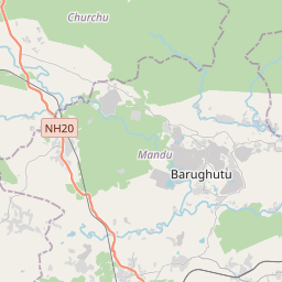


Leaflet | © OpenStreetMap
How far is it between Bokāro and Kuju
Bokaro is located in India with (23.7873,85.9562) coordinates and Kuju is located in India with (23.7276,85.5062) coordinates. The calculated flying distance from Bokaro to Kuju is equal to 29 miles which is equal to 46 km.
If you want to go by car, the driving distance between Bokaro and Kuju is 63.55 km. If you ride your car with an average speed of 112 kilometers/hour (70 miles/h), travel time will be 00 hours 34 minutes. Please check the avg. speed travel time table on the right for various options.
Difference between fly and go by a car is 18 km.
| City/Place | Latitude and Longitude | GPS Coordinates |
|---|---|---|
| Bokaro | 23.7873, 85.9562 | 23° 47´ 14.3520'' N 85° 57´ 22.3920'' E |
| Kuju | 23.7276, 85.5062 | 23° 43´ 39.2520'' N 85° 30´ 22.1760'' E |
Estimated Travel Time Between Bokāro and Kuju
| Average Speed | Travel Time |
|---|---|
| 30 mph (48 km/h) | 01 hours 19 minutes |
| 40 mph (64 km/h) | 00 hours 59 minutes |
| 50 mph (80 km/h) | 00 hours 47 minutes |
| 60 mph (97 km/h) | 00 hours 39 minutes |
| 70 mph (112 km/h) | 00 hours 34 minutes |
| 75 mph (120 km/h) | 00 hours 31 minutes |
Bokaro, Ranchi, India
Related Distances from Bokaro
| Cities | Distance |
|---|---|
| Bokaro to Chas | 39 km |
| Bokaro to Gumia | 17 km |
| Bokaro to Chatra | 157 km |
| Bokaro to Katras | 47 km |
| Bokaro to Giridih | 82 km |
Kuju, Ranchi, India
Related Distances to Kuju
| Cities | Distance |
|---|---|
| Bokaro to Kuju | 64 km |
| Chaibasa to Kuju | 197 km |
| Dhanbad to Kuju | 122 km |
| Barka Kana to Kuju | 19 km |
| Hazaribag to Kuju | 37 km |