Distance from Bouira to Chlef
Distance between Bouira and Chlef is 231 kilometers (144 miles).
Driving distance from Bouira to Chlef is 294 kilometers (182 miles).
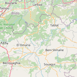
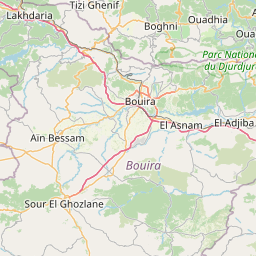
Distance Map Between Bouira and Chlef
Bouira, Algeria ↔ Chlef, Algeria = 144 miles = 231 km.


How far is it between Bouïra and Chlef
Bouira is located in Algeria with (36.3749,3.902) coordinates and Chlef is located in Algeria with (36.1653,1.3345) coordinates. The calculated flying distance from Bouira to Chlef is equal to 144 miles which is equal to 231 km.
If you want to go by car, the driving distance between Bouira and Chlef is 293.63 km. If you ride your car with an average speed of 112 kilometers/hour (70 miles/h), travel time will be 02 hours 37 minutes. Please check the avg. speed travel time table on the right for various options.
Difference between fly and go by a car is 63 km.
| City/Place | Latitude and Longitude | GPS Coordinates |
|---|---|---|
| Bouira | 36.3749, 3.902 | 36° 22´ 29.6040'' N 3° 54´ 7.2000'' E |
| Chlef | 36.1653, 1.3345 | 36° 9´ 54.9000'' N 1° 20´ 4.2720'' E |
Estimated Travel Time Between Bouïra and Chlef
| Average Speed | Travel Time |
|---|---|
| 30 mph (48 km/h) | 06 hours 07 minutes |
| 40 mph (64 km/h) | 04 hours 35 minutes |
| 50 mph (80 km/h) | 03 hours 40 minutes |
| 60 mph (97 km/h) | 03 hours 01 minutes |
| 70 mph (112 km/h) | 02 hours 37 minutes |
| 75 mph (120 km/h) | 02 hours 26 minutes |
Related Distances from Bouira
| Cities | Distance |
|---|---|
| Bouira to M Sila | 130 km |
| Bouira to Oran | 504 km |
| Bouira to Tizi Ouzou | 77 km |
| Bouira to Jijel | 294 km |
| Bouira to Tamanrasset | 1914 km |
Related Distances to Chlef
| Cities | Distance |
|---|---|
| Ain Defla to Chlef | 62 km |
| Algiers to Chlef | 206 km |
| Blida to Chlef | 162 km |
| Batna to Chlef | 583 km |
| Constantine to Chlef | 579 km |