Distance from Boynton Beach to Gustavo A. Madero
Distance between Boynton Beach and Gustavo A. Madero is 1930 kilometers (1199 miles).
Driving distance from Boynton Beach to Gustavo A. Madero is 2818 kilometers (1751 miles).
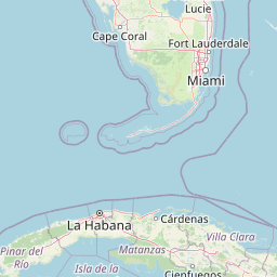
Distance Map Between Boynton Beach and Gustavo A. Madero
Boynton Beach, Tallahassee, United States ↔ Gustavo A. Madero, Ciudad Victoria, Mexico = 1199 miles = 1930 km.


How far is it between Boynton Beach and Gustavo A. Madero
Boynton Beach is located in United States with (26.5254,-80.0664) coordinates and Gustavo A. Madero is located in Mexico with (22.8694,-98.7589) coordinates. The calculated flying distance from Boynton Beach to Gustavo A. Madero is equal to 1199 miles which is equal to 1930 km.
If you want to go by car, the driving distance between Boynton Beach and Gustavo A. Madero is 2818.29 km. If you ride your car with an average speed of 112 kilometers/hour (70 miles/h), travel time will be 25 hours 09 minutes. Please check the avg. speed travel time table on the right for various options.
Difference between fly and go by a car is 888 km.
| City/Place | Latitude and Longitude | GPS Coordinates |
|---|---|---|
| Boynton Beach | 26.5254, -80.0664 | 26° 31´ 31.2600'' N 80° 3´ 59.1480'' W |
| Gustavo A. Madero | 22.8694, -98.7589 | 22° 52´ 9.8400'' N 98° 45´ 31.8960'' W |
Estimated Travel Time Between Boynton Beach and Gustavo A. Madero
| Average Speed | Travel Time |
|---|---|
| 30 mph (48 km/h) | 58 hours 42 minutes |
| 40 mph (64 km/h) | 44 hours 02 minutes |
| 50 mph (80 km/h) | 35 hours 13 minutes |
| 60 mph (97 km/h) | 29 hours 03 minutes |
| 70 mph (112 km/h) | 25 hours 09 minutes |
| 75 mph (120 km/h) | 23 hours 29 minutes |
Related Distances from Boynton Beach
| Cities | Distance |
|---|---|
| Boynton Beach to Ciudad Nezahualcoyotl | 3432 km |
| Boynton Beach to Alvaro Obregon | 3429 km |
| Boynton Beach to Naucalpan De Juarez | 3414 km |
| Boynton Beach to Tlalnepantla | 3490 km |
| Boynton Beach to Merida | 4369 km |
Related Distances to Gustavo A. Madero
| Cities | Distance |
|---|---|
| Channelview to Gustavo A Madero 2 | 1020 km |
| Santa Fe to Gustavo A Madero 2 | 1981 km |
| Austin to Gustavo A Madero 2 | 965 km |
| Olive Branch to Gustavo A Madero 2 | 1944 km |
| Tallahassee to Gustavo A Madero 2 | 2135 km |