Distance from Brasschaat to Deinze
Distance between Brasschaat and Deinze is 75 kilometers (47 miles).
Driving distance from Brasschaat to Deinze is 90 kilometers (56 miles).
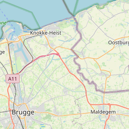
Distance Map Between Brasschaat and Deinze
Brasschaat, , Belgium ↔ Deinze, , Belgium = 47 miles = 75 km.


How far is it between Brasschaat and Deinze
Brasschaat is located in Belgium with (51.2912,4.4918) coordinates and Deinze is located in Belgium with (50.9818,3.531) coordinates. The calculated flying distance from Brasschaat to Deinze is equal to 47 miles which is equal to 75 km.
If you want to go by car, the driving distance between Brasschaat and Deinze is 89.87 km. If you ride your car with an average speed of 112 kilometers/hour (70 miles/h), travel time will be 00 hours 48 minutes. Please check the avg. speed travel time table on the right for various options.
Difference between fly and go by a car is 15 km.
| City/Place | Latitude and Longitude | GPS Coordinates |
|---|---|---|
| Brasschaat | 51.2912, 4.4918 | 51° 17´ 28.3200'' N 4° 29´ 30.5520'' E |
| Deinze | 50.9818, 3.531 | 50° 58´ 54.3000'' N 3° 31´ 51.4560'' E |
Estimated Travel Time Between Brasschaat and Deinze
| Average Speed | Travel Time |
|---|---|
| 30 mph (48 km/h) | 01 hours 52 minutes |
| 40 mph (64 km/h) | 01 hours 24 minutes |
| 50 mph (80 km/h) | 01 hours 07 minutes |
| 60 mph (97 km/h) | 00 hours 55 minutes |
| 70 mph (112 km/h) | 00 hours 48 minutes |
| 75 mph (120 km/h) | 00 hours 44 minutes |
Related Distances from Brasschaat
| Cities | Distance |
|---|---|
| Brasschaat to Herentals | 41 km |
| Brasschaat to Schilde | 10 km |
| Brasschaat to Duffel | 34 km |
| Brasschaat to Schoten | 7 km |
| Brasschaat to Leuven | 76 km |
Related Distances to Deinze
| Cities | Distance |
|---|---|
| Brugge to Deinze | 44 km |
| Antwerpen to Deinze | 75 km |
| Asse to Deinze | 58 km |
| Beveren to Deinze | 66 km |
| Aalter to Deinze | 15 km |