Distance from Bremerton to Yellowknife
Distance between Bremerton and Yellowknife is 1734 kilometers (1078 miles).
Driving distance from Bremerton to Yellowknife is 2492 kilometers (1548 miles).
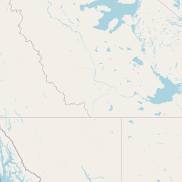
Distance Map Between Bremerton and Yellowknife
Bremerton, Olympia, United States ↔ Yellowknife, Canada = 1078 miles = 1734 km.


How far is it between Bremerton and Yellowknife
Bremerton is located in United States with (47.5673,-122.6326) coordinates and Yellowknife is located in Canada with (62.456,-114.3526) coordinates. The calculated flying distance from Bremerton to Yellowknife is equal to 1078 miles which is equal to 1734 km.
If you want to go by car, the driving distance between Bremerton and Yellowknife is 2491.84 km. If you ride your car with an average speed of 112 kilometers/hour (70 miles/h), travel time will be 22 hours 14 minutes. Please check the avg. speed travel time table on the right for various options.
Difference between fly and go by a car is 758 km.
| City/Place | Latitude and Longitude | GPS Coordinates |
|---|---|---|
| Bremerton | 47.5673, -122.6326 | 47° 34´ 2.3520'' N 122° 37´ 57.5040'' W |
| Yellowknife | 62.456, -114.3526 | 62° 27´ 21.6000'' N 114° 21´ 9.1800'' W |
Estimated Travel Time Between Bremerton and Yellowknife
| Average Speed | Travel Time |
|---|---|
| 30 mph (48 km/h) | 51 hours 54 minutes |
| 40 mph (64 km/h) | 38 hours 56 minutes |
| 50 mph (80 km/h) | 31 hours 08 minutes |
| 60 mph (97 km/h) | 25 hours 41 minutes |
| 70 mph (112 km/h) | 22 hours 14 minutes |
| 75 mph (120 km/h) | 20 hours 45 minutes |
Related Distances from Bremerton
| Cities | Distance |
|---|---|
| Bremerton to Ontario | 1880 km |
| Bremerton to Victoria | 163 km |
| Bremerton to Kelowna | 604 km |
| Bremerton to Calgary | 1209 km |
| Bremerton to Surrey | 297 km |
Related Distances to Yellowknife
| Cities | Distance |
|---|---|
| Seattle to Yellowknife | 2388 km |
| Spokane to Yellowknife | 2431 km |
| Coeur D Alene to Yellowknife | 2387 km |
| Bellingham to Yellowknife | 2341 km |
| Grand Forks to Yellowknife | 2938 km |