Distance from Brockton to Auburn
Distance between Brockton and Auburn is 69 kilometers (43 miles).
Driving distance from Brockton to Auburn is 98 kilometers (61 miles).
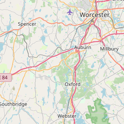
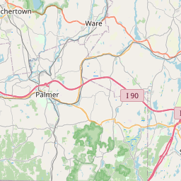
Distance Map Between Brockton and Auburn
Brockton, Boston, United States ↔ Auburn, Boston, United States = 43 miles = 69 km.


How far is it between Brockton and Auburn
Brockton is located in United States with (42.0834,-71.0184) coordinates and Auburn is located in United States with (42.1945,-71.8356) coordinates. The calculated flying distance from Brockton to Auburn is equal to 43 miles which is equal to 69 km.
If you want to go by car, the driving distance between Brockton and Auburn is 98.26 km. If you ride your car with an average speed of 112 kilometers/hour (70 miles/h), travel time will be 00 hours 52 minutes. Please check the avg. speed travel time table on the right for various options.
Difference between fly and go by a car is 29 km.
| City/Place | Latitude and Longitude | GPS Coordinates |
|---|---|---|
| Brockton | 42.0834, -71.0184 | 42° 5´ 0.3480'' N 71° 1´ 6.1680'' W |
| Auburn | 42.1945, -71.8356 | 42° 11´ 40.3440'' N 71° 50´ 8.2680'' W |
Estimated Travel Time Between Brockton and Auburn
| Average Speed | Travel Time |
|---|---|
| 30 mph (48 km/h) | 02 hours 02 minutes |
| 40 mph (64 km/h) | 01 hours 32 minutes |
| 50 mph (80 km/h) | 01 hours 13 minutes |
| 60 mph (97 km/h) | 01 hours 00 minutes |
| 70 mph (112 km/h) | 00 hours 52 minutes |
| 75 mph (120 km/h) | 00 hours 49 minutes |
Related Distances from Brockton
| Cities | Distance |
|---|---|
| Brockton to Attleboro | 33 km |
| Brockton to Braintree 2 | 24 km |
| Brockton to North Andover | 83 km |
| Brockton to Abington | 7 km |
| Brockton to Barnstable | 102 km |
Related Distances to Auburn
| Cities | Distance |
|---|---|
| Chelsea 2 to Auburn 5 | 83 km |
| Worcester to Auburn 5 | 10 km |
| Quincy to Auburn 5 | 92 km |
| Milton 3 to Auburn 5 | 88 km |
| Cambridge 3 to Auburn 5 | 72 km |