Distance from Bulacan to Lubao
Distance between Bulacan and Lubao is 34 kilometers (21 miles).
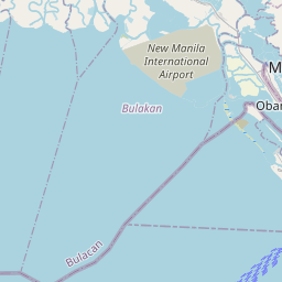
Driving distance from Bulacan to Lubao is 54 kilometers (34 miles).
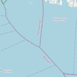
Distance Map Between Bulacan and Lubao
Bulacan, , Philippines ↔ Lubao, , Philippines = 21 miles = 34 km.


How far is it between Bulacan and Lubao
Bulacan is located in Philippines with (14.7928,120.8789) coordinates and Lubao is located in Philippines with (14.9405,120.6011) coordinates. The calculated flying distance from Bulacan to Lubao is equal to 21 miles which is equal to 34 km.
If you want to go by car, the driving distance between Bulacan and Lubao is 54.38 km. If you ride your car with an average speed of 112 kilometers/hour (70 miles/h), travel time will be 00 hours 29 minutes. Please check the avg. speed travel time table on the right for various options.
Difference between fly and go by a car is 20 km.
| City/Place | Latitude and Longitude | GPS Coordinates |
|---|---|---|
| Bulacan | 14.7928, 120.8789 | 14° 47´ 34.0080'' N 120° 52´ 44.0040'' E |
| Lubao | 14.9405, 120.6011 | 14° 56´ 25.8000'' N 120° 36´ 3.9600'' E |
Estimated Travel Time Between Bulacan and Lubao
| Average Speed | Travel Time |
|---|---|
| 30 mph (48 km/h) | 01 hours 07 minutes |
| 40 mph (64 km/h) | 00 hours 50 minutes |
| 50 mph (80 km/h) | 00 hours 40 minutes |
| 60 mph (97 km/h) | 00 hours 33 minutes |
| 70 mph (112 km/h) | 00 hours 29 minutes |
| 75 mph (120 km/h) | 00 hours 27 minutes |
Related Distances from Bulacan
| Cities | Distance |
|---|---|
| Bulacan to Tarlac City | 103 km |
| Bulacan to Quezon 2 | 122 km |
| Bulacan to Rizal | 159 km |
| Bulacan to Subic | 107 km |
| Bulacan to Cabanatuan City | 132 km |
Related Distances to Lubao
| Cities | Distance |
|---|---|
| Angeles City to Lubao | 35 km |
| Arayat to Lubao | 43 km |
| Dinalupihan to Lubao | 21 km |
| Balanga to Lubao | 41 km |
| Apalit to Lubao | 32 km |