Distance from Bulaon to Iba
Distance between Bulaon and Iba is 78 kilometers (49 miles).
Driving distance from Bulaon to Iba is 165 kilometers (102 miles).
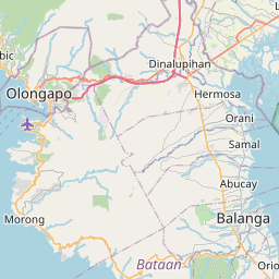
Distance Map Between Bulaon and Iba
Bulaon, , Philippines ↔ Iba, , Philippines = 49 miles = 78 km.


How far is it between Bulaon and Iba
Bulaon is located in Philippines with (15.0826,120.6629) coordinates and Iba is located in Philippines with (15.3276,119.978) coordinates. The calculated flying distance from Bulaon to Iba is equal to 49 miles which is equal to 78 km.
If you want to go by car, the driving distance between Bulaon and Iba is 164.83 km. If you ride your car with an average speed of 112 kilometers/hour (70 miles/h), travel time will be 01 hours 28 minutes. Please check the avg. speed travel time table on the right for various options.
Difference between fly and go by a car is 87 km.
| City/Place | Latitude and Longitude | GPS Coordinates |
|---|---|---|
| Bulaon | 15.0826, 120.6629 | 15° 4´ 57.4320'' N 120° 39´ 46.3680'' E |
| Iba | 15.3276, 119.978 | 15° 19´ 39.3600'' N 119° 58´ 40.8000'' E |
Estimated Travel Time Between Bulaon and Iba
| Average Speed | Travel Time |
|---|---|
| 30 mph (48 km/h) | 03 hours 26 minutes |
| 40 mph (64 km/h) | 02 hours 34 minutes |
| 50 mph (80 km/h) | 02 hours 03 minutes |
| 60 mph (97 km/h) | 01 hours 41 minutes |
| 70 mph (112 km/h) | 01 hours 28 minutes |
| 75 mph (120 km/h) | 01 hours 22 minutes |
Related Distances from Bulaon
| Cities | Distance |
|---|---|
| Bulaon to San Fernando | 9 km |
| Bulaon to Mexico | 14 km |
| Bulaon to Pandacaqui | 19 km |
| Bulaon to Porac | 20 km |
| Bulaon to Tarlac City | 64 km |
Related Distances to Iba
| Cities | Distance |
|---|---|
| Botolan to Iba | 7 km |
| Castillejos to Iba | 59 km |
| Angeles City to Iba | 154 km |
| Bulacan to Iba | 204 km |
| Hermosa to Iba | 108 km |