Distance from Buldana to Dhule
Distance between Buldana and Dhule is 152 kilometers (95 miles).
Driving distance from Buldana to Dhule is 189 kilometers (118 miles).
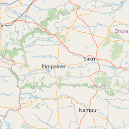
Distance Map Between Buldana and Dhule
Buldana, Mumbai, India ↔ Dhule, Mumbai, India = 95 miles = 152 km.


How far is it between Buldāna and Dhule
Buldana is located in India with (20.5293,76.1846) coordinates and Dhule is located in India with (20.9025,74.7774) coordinates. The calculated flying distance from Buldana to Dhule is equal to 95 miles which is equal to 152 km.
If you want to go by car, the driving distance between Buldana and Dhule is 189.43 km. If you ride your car with an average speed of 112 kilometers/hour (70 miles/h), travel time will be 01 hours 41 minutes. Please check the avg. speed travel time table on the right for various options.
Difference between fly and go by a car is 37 km.
| City/Place | Latitude and Longitude | GPS Coordinates |
|---|---|---|
| Buldana | 20.5293, 76.1846 | 20° 31´ 45.5880'' N 76° 11´ 4.4520'' E |
| Dhule | 20.9025, 74.7774 | 20° 54´ 9.0360'' N 74° 46´ 38.4600'' E |
Estimated Travel Time Between Buldāna and Dhule
| Average Speed | Travel Time |
|---|---|
| 30 mph (48 km/h) | 03 hours 56 minutes |
| 40 mph (64 km/h) | 02 hours 57 minutes |
| 50 mph (80 km/h) | 02 hours 22 minutes |
| 60 mph (97 km/h) | 01 hours 57 minutes |
| 70 mph (112 km/h) | 01 hours 41 minutes |
| 75 mph (120 km/h) | 01 hours 34 minutes |
Related Distances from Buldana
| Cities | Distance |
|---|---|
| Buldana to Jalgaon Jamod | 82 km |
| Buldana to Deulgaon Raja | 80 km |
| Buldana to Faizpur | 106 km |
| Buldana to Jintur | 157 km |
| Buldana to Parli Vaijnath | 246 km |
Related Distances to Dhule
| Cities | Distance |
|---|---|
| Amalner to Dhule | 37 km |
| Chandvad to Dhule | 96 km |
| Aurangabad to Dhule | 150 km |
| Arvi to Dhule | 429 km |
| Chopda to Dhule | 74 km |