Distance from Businovo to Taganskiy
Distance between Businovo and Taganskiy is 20 kilometers (12 miles).
Driving distance from Businovo to Taganskiy is 27 kilometers (17 miles).
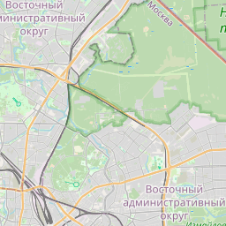
Distance Map Between Businovo and Taganskiy
Businovo, Moscow, Russia ↔ Taganskiy, Moscow, Russia = 12 miles = 20 km.


How far is it between Businovo and Taganskiy
Businovo is located in Russia with (55.8833,37.5) coordinates and Taganskiy is located in Russia with (55.7333,37.6667) coordinates. The calculated flying distance from Businovo to Taganskiy is equal to 12 miles which is equal to 20 km.
If you want to go by car, the driving distance between Businovo and Taganskiy is 27.11 km. If you ride your car with an average speed of 112 kilometers/hour (70 miles/h), travel time will be 00 hours 14 minutes. Please check the avg. speed travel time table on the right for various options.
Difference between fly and go by a car is 7 km.
| City/Place | Latitude and Longitude | GPS Coordinates |
|---|---|---|
| Businovo | 55.8833, 37.5 | 55° 52´ 59.9880'' N 37° 30´ 0.0000'' E |
| Taganskiy | 55.7333, 37.6667 | 55° 43´ 59.9880'' N 37° 40´ 0.0120'' E |
Estimated Travel Time Between Businovo and Taganskiy
| Average Speed | Travel Time |
|---|---|
| 30 mph (48 km/h) | 00 hours 33 minutes |
| 40 mph (64 km/h) | 00 hours 25 minutes |
| 50 mph (80 km/h) | 00 hours 20 minutes |
| 60 mph (97 km/h) | 00 hours 16 minutes |
| 70 mph (112 km/h) | 00 hours 14 minutes |
| 75 mph (120 km/h) | 00 hours 13 minutes |
Related Distances from Businovo
| Cities | Distance |
|---|---|
| Businovo to Ryazanskiy | 43 km |
| Businovo to Mar Ina Roshcha | 17 km |
| Businovo to Tyoply Stan | 40 km |
| Businovo to Veshnyaki | 40 km |
| Businovo to Sokol | 17 km |
Related Distances to Taganskiy
| Cities | Distance |
|---|---|
| Sokol to Taganskiy | 19 km |
| Mar Ino to Taganskiy | 13 km |
| Bibirevo to Taganskiy | 22 km |
| Novokuz Minki to Taganskiy | 9 km |
| Amin Yevo to Taganskiy | 20 km |