Distance from Butte to Calgary
Distance between Butte and Calgary is 573 kilometers (356 miles).
Driving distance from Butte to Calgary is 755 kilometers (469 miles).
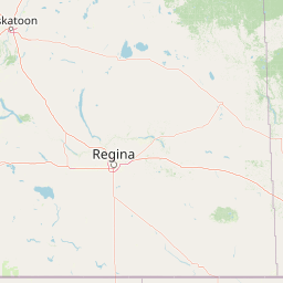
Distance Map Between Butte and Calgary
Butte, Helena, United States ↔ Calgary, Edmonton, Canada = 356 miles = 573 km.


How far is it between Butte and Calgary
Butte is located in United States with (46.0038,-112.5347) coordinates and Calgary is located in Canada with (51.0501,-114.0853) coordinates. The calculated flying distance from Butte to Calgary is equal to 356 miles which is equal to 573 km.
If you want to go by car, the driving distance between Butte and Calgary is 754.82 km. If you ride your car with an average speed of 112 kilometers/hour (70 miles/h), travel time will be 06 hours 44 minutes. Please check the avg. speed travel time table on the right for various options.
Difference between fly and go by a car is 182 km.
| City/Place | Latitude and Longitude | GPS Coordinates |
|---|---|---|
| Butte | 46.0038, -112.5347 | 46° 0´ 13.7520'' N 112° 32´ 5.0640'' W |
| Calgary | 51.0501, -114.0853 | 51° 3´ 0.3960'' N 114° 5´ 7.0440'' W |
Estimated Travel Time Between Butte and Calgary
| Average Speed | Travel Time |
|---|---|
| 30 mph (48 km/h) | 15 hours 43 minutes |
| 40 mph (64 km/h) | 11 hours 47 minutes |
| 50 mph (80 km/h) | 09 hours 26 minutes |
| 60 mph (97 km/h) | 07 hours 46 minutes |
| 70 mph (112 km/h) | 06 hours 44 minutes |
| 75 mph (120 km/h) | 06 hours 17 minutes |
Related Distances from Butte
| Cities | Distance |
|---|---|
| Butte to Calgary | 755 km |
| Butte to Winnipeg | 1522 km |
| Butte to Edmonton | 1008 km |
| Butte to Regina | 993 km |
| Butte to Vancouver | 1168 km |
Related Distances to Calgary
| Cities | Distance |
|---|---|
| Salt Lake City to Calgary | 1423 km |
| Golden to Calgary | 1764 km |
| Seattle to Calgary | 1080 km |
| Idaho Falls to Calgary | 1089 km |
| Las Vegas to Calgary | 2057 km |