Distance from Cabo to Moreno
Distance between Cabo and Moreno is 19 kilometers (12 miles).
Driving distance from Cabo to Moreno is 43 kilometers (27 miles).
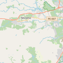
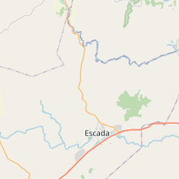
Distance Map Between Cabo and Moreno
Cabo, Recife, Brazil ↔ Moreno, Recife, Brazil = 12 miles = 19 km.


How far is it between Cabo and Moreno
Cabo is located in Brazil with (-8.2833,-35.0333) coordinates and Moreno is located in Brazil with (-8.1186,-35.0922) coordinates. The calculated flying distance from Cabo to Moreno is equal to 12 miles which is equal to 19 km.
If you want to go by car, the driving distance between Cabo and Moreno is 42.72 km. If you ride your car with an average speed of 112 kilometers/hour (70 miles/h), travel time will be 00 hours 22 minutes. Please check the avg. speed travel time table on the right for various options.
Difference between fly and go by a car is 24 km.
| City/Place | Latitude and Longitude | GPS Coordinates |
|---|---|---|
| Cabo | -8.2833, -35.0333 | 8° 16´ 59.9880'' S 35° 1´ 59.9880'' W |
| Moreno | -8.1186, -35.0922 | 8° 7´ 6.9960'' S 35° 5´ 31.9920'' W |
Estimated Travel Time Between Cabo and Moreno
| Average Speed | Travel Time |
|---|---|
| 30 mph (48 km/h) | 00 hours 53 minutes |
| 40 mph (64 km/h) | 00 hours 40 minutes |
| 50 mph (80 km/h) | 00 hours 32 minutes |
| 60 mph (97 km/h) | 00 hours 26 minutes |
| 70 mph (112 km/h) | 00 hours 22 minutes |
| 75 mph (120 km/h) | 00 hours 21 minutes |
Related Distances from Cabo
| Cities | Distance |
|---|---|
| Cabo to Paulista | 52 km |
| Cabo to Tamandare | 74 km |
| Cabo to Surubim | 146 km |
| Cabo to Sao Lourenco Da Mata | 52 km |
| Cabo to Santa Cruz Do Capibaribe | 199 km |
Related Distances to Moreno
| Cities | Distance |
|---|---|
| Belo Jardim to Moreno | 157 km |
| Jaboatao Dos Guararapes to Moreno | 10 km |
| Ipojuca to Moreno | 59 km |
| Custodia to Moreno | 310 km |
| Floresta to Moreno | 409 km |