Distance from Cali to Yopal
Distance between Cali and Yopal is 504 kilometers (313 miles).
Driving distance from Cali to Yopal is 813 kilometers (505 miles).
Distance Map Between Cali and Yopal
Cali, Colombia ↔ Yopal, Colombia = 313 miles = 504 km.

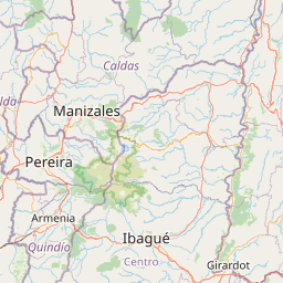
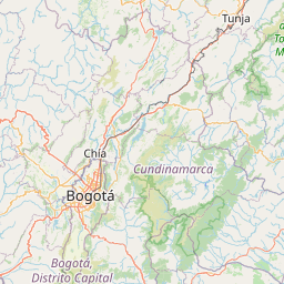
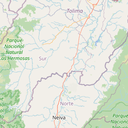
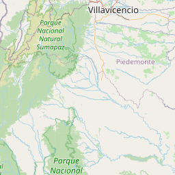

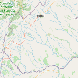


Leaflet | © OpenStreetMap
How far is it between Cali and Yopal
Cali is located in Colombia with (3.4372,-76.5225) coordinates and Yopal is located in Colombia with (5.3378,-72.3959) coordinates. The calculated flying distance from Cali to Yopal is equal to 313 miles which is equal to 504 km.
If you want to go by car, the driving distance between Cali and Yopal is 812.91 km. If you ride your car with an average speed of 112 kilometers/hour (70 miles/h), travel time will be 07 hours 15 minutes. Please check the avg. speed travel time table on the right for various options.
Difference between fly and go by a car is 309 km.
| City/Place | Latitude and Longitude | GPS Coordinates |
|---|---|---|
| Cali | 3.4372, -76.5225 | 3° 26´ 13.9920'' N 76° 31´ 21.0000'' W |
| Yopal | 5.3378, -72.3959 | 5° 20´ 15.9000'' N 72° 23´ 45.0960'' W |
Estimated Travel Time Between Cali and Yopal
| Average Speed | Travel Time |
|---|---|
| 30 mph (48 km/h) | 16 hours 56 minutes |
| 40 mph (64 km/h) | 12 hours 42 minutes |
| 50 mph (80 km/h) | 10 hours 09 minutes |
| 60 mph (97 km/h) | 08 hours 22 minutes |
| 70 mph (112 km/h) | 07 hours 15 minutes |
| 75 mph (120 km/h) | 06 hours 46 minutes |
Cali, Colombia
Related Distances from Cali
| Cities | Distance |
|---|---|
| Cali to Medellin | 423 km |
| Cali to Cartagena | 1063 km |
| Cali to Pereira | 210 km |
| Cali to Popayan | 138 km |
| Cali to Pasto | 385 km |
Yopal, Colombia
Related Distances to Yopal
| Cities | Distance |
|---|---|
| Bogota to Yopal | 366 km |
| Cartagena to Yopal | 1141 km |
| Pereira to Yopal | 671 km |
| Tunja to Yopal | 218 km |
| Manizales to Yopal | 610 km |