Distance from Camayenne to Kumasi
Distance between Camayenne and Kumasi is 1365 kilometers (848 miles).
Driving distance from Camayenne to Kumasi is 1903 kilometers (1183 miles).
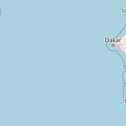
Distance Map Between Camayenne and Kumasi
Camayenne, Conakry, Guinea ↔ Kumasi, Ghana = 848 miles = 1365 km.


How far is it between Camayenne and Kumasi
Camayenne is located in Guinea with (9.535,-13.6878) coordinates and Kumasi is located in Ghana with (6.6885,-1.6244) coordinates. The calculated flying distance from Camayenne to Kumasi is equal to 848 miles which is equal to 1365 km.
If you want to go by car, the driving distance between Camayenne and Kumasi is 1903.33 km. If you ride your car with an average speed of 112 kilometers/hour (70 miles/h), travel time will be 16 hours 59 minutes. Please check the avg. speed travel time table on the right for various options.
Difference between fly and go by a car is 538 km.
| City/Place | Latitude and Longitude | GPS Coordinates |
|---|---|---|
| Camayenne | 9.535, -13.6878 | 9° 32´ 6.0000'' N 13° 41´ 16.0080'' W |
| Kumasi | 6.6885, -1.6244 | 6° 41´ 18.5280'' N 1° 37´ 27.9480'' W |
Estimated Travel Time Between Camayenne and Kumasi
| Average Speed | Travel Time |
|---|---|
| 30 mph (48 km/h) | 39 hours 39 minutes |
| 40 mph (64 km/h) | 29 hours 44 minutes |
| 50 mph (80 km/h) | 23 hours 47 minutes |
| 60 mph (97 km/h) | 19 hours 37 minutes |
| 70 mph (112 km/h) | 16 hours 59 minutes |
| 75 mph (120 km/h) | 15 hours 51 minutes |
Related Distances from Camayenne
| Cities | Distance |
|---|---|
| Camayenne to Accra | 2161 km |
| Camayenne to Sunyani | 1756 km |
| Camayenne to Kintampo | 1879 km |
| Camayenne to Cape Coast | 1991 km |
| Camayenne to Shama Junction | 1922 km |
Related Distances to Kumasi
| Cities | Distance |
|---|---|
| Kankan to Kumasi | 1191 km |
| Conakry to Kumasi | 1881 km |
| Nzerekore to Kumasi | 1018 km |
| Pita to Kumasi | 1697 km |
| Coyah to Kumasi | 1849 km |