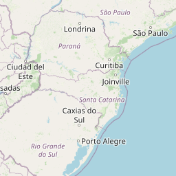
Distance from Cambara to Lapa
Distance between Cambara and Lapa is 305 kilometers (189 miles).
Distance Map Between Cambara and Lapa
Cambara, Curitiba, Brazil ↔ Lapa, Curitiba, Brazil = 189 miles = 305 km.


Leaflet | © OpenStreetMap
How far is it between Cambará and Lapa
Cambara is located in Brazil with (-23.0464,-50.0736) coordinates and Lapa is located in Brazil with (-25.7697,-49.7158) coordinates. The calculated flying distance from Cambara to Lapa is equal to 189 miles which is equal to 305 km.
| City/Place | Latitude and Longitude | GPS Coordinates |
|---|---|---|
| Cambara | -23.0464, -50.0736 | 23° 2´ 47.0040'' S 50° 4´ 24.9960'' W |
| Lapa | -25.7697, -49.7158 | 25° 46´ 10.9920'' S 49° 42´ 56.9880'' W |
Cambara, Curitiba, Brazil
Related Distances from Cambara
| Cities | Distance |
|---|---|
| Cambara to Santo Antonio Da Platina | 39 km |
| Cambara to Ponta Grossa | 285 km |
| Cambara to Campina Grande Do Sul | 432 km |
| Cambara to Pirai Do Sul | 213 km |
| Cambara to Jacarezinho | 20 km |
Lapa, Curitiba, Brazil
Related Distances to Lapa
| Cities | Distance |
|---|---|
| Cruzeiro Do Oeste to Lapa | 534 km |
| Campo Mourao to Lapa | 431 km |
| Araucaria to Lapa | 43 km |
| Almirante Tamandare to Lapa | 85 km |
| Foz Do Iguacu to Lapa | 612 km |