Distance from Canete to Lebu
Distance between Canete and Lebu is 31 kilometers (19 miles).
Driving distance from Canete to Lebu is 52 kilometers (33 miles).
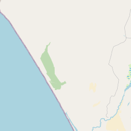
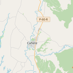
Distance Map Between Canete and Lebu
Canete, Concepcion, Chile ↔ Lebu, Concepcion, Chile = 19 miles = 31 km.


How far is it between Cañete and Lebu
Canete is located in Chile with (-37.8013,-73.3962) coordinates and Lebu is located in Chile with (-37.6083,-73.6536) coordinates. The calculated flying distance from Canete to Lebu is equal to 19 miles which is equal to 31 km.
If you want to go by car, the driving distance between Canete and Lebu is 52.35 km. If you ride your car with an average speed of 112 kilometers/hour (70 miles/h), travel time will be 00 hours 28 minutes. Please check the avg. speed travel time table on the right for various options.
Difference between fly and go by a car is 21 km.
| City/Place | Latitude and Longitude | GPS Coordinates |
|---|---|---|
| Canete | -37.8013, -73.3962 | 37° 48´ 4.6080'' S 73° 23´ 46.1760'' W |
| Lebu | -37.6083, -73.6536 | 37° 36´ 29.7000'' S 73° 39´ 12.8160'' W |
Estimated Travel Time Between Cañete and Lebu
| Average Speed | Travel Time |
|---|---|
| 30 mph (48 km/h) | 01 hours 05 minutes |
| 40 mph (64 km/h) | 00 hours 49 minutes |
| 50 mph (80 km/h) | 00 hours 39 minutes |
| 60 mph (97 km/h) | 00 hours 32 minutes |
| 70 mph (112 km/h) | 00 hours 28 minutes |
| 75 mph (120 km/h) | 00 hours 26 minutes |
Related Distances from Canete
| Cities | Distance |
|---|---|
| Canete to Los Angeles 2 | 163 km |
| Canete to Talcahuano | 146 km |
| Canete to Chiguayante | 145 km |
| Canete to Lebu | 52 km |
| Canete to Lota | 97 km |
Related Distances to Lebu
| Cities | Distance |
|---|---|
| Arauco to Lebu | 64 km |
| Curanilahue to Lebu | 56 km |
| Canete to Lebu | 52 km |
| La Laja to Lebu | 238 km |
| Chiguayante to Lebu | 151 km |