Distance from Carlingford to Nowra
Distance between Carlingford and Nowra is 129 kilometers (80 miles).
Driving distance from Carlingford to Nowra is 164 kilometers (102 miles).
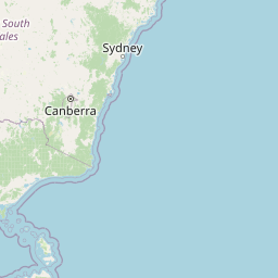
Distance Map Between Carlingford and Nowra
Carlingford, Sydney, Australia ↔ Nowra, Sydney, Australia = 80 miles = 129 km.

How far is it between Carlingford and Nowra
Carlingford is located in Australia with (-33.7827,151.0489) coordinates and Nowra is located in Australia with (-34.8842,150.6004) coordinates. The calculated flying distance from Carlingford to Nowra is equal to 80 miles which is equal to 129 km.
If you want to go by car, the driving distance between Carlingford and Nowra is 163.97 km. If you ride your car with an average speed of 112 kilometers/hour (70 miles/h), travel time will be 01 hours 27 minutes. Please check the avg. speed travel time table on the right for various options.
Difference between fly and go by a car is 35 km.
| City/Place | Latitude and Longitude | GPS Coordinates |
|---|---|---|
| Carlingford | -33.7827, 151.0489 | 33° 46´ 57.6840'' S 151° 2´ 55.9680'' E |
| Nowra | -34.8842, 150.6004 | 34° 53´ 3.1920'' S 150° 36´ 1.2960'' E |
Estimated Travel Time Between Carlingford and Nowra
| Average Speed | Travel Time |
|---|---|
| 30 mph (48 km/h) | 03 hours 24 minutes |
| 40 mph (64 km/h) | 02 hours 33 minutes |
| 50 mph (80 km/h) | 02 hours 02 minutes |
| 60 mph (97 km/h) | 01 hours 41 minutes |
| 70 mph (112 km/h) | 01 hours 27 minutes |
| 75 mph (120 km/h) | 01 hours 21 minutes |
Related Distances from Carlingford
| Cities | Distance |
|---|---|
| Carlingford to Liverpool 2 | 22 km |
| Carlingford to Castle Hill | 10 km |
| Carlingford to Newcastle 2 | 147 km |
| Carlingford to Nowra | 164 km |
| Carlingford to Wollongong | 87 km |
Related Distances to Nowra
| Cities | Distance |
|---|---|
| Wollongong to Nowra | 80 km |
| Goulburn to Nowra | 126 km |
| Griffith 2 to Nowra | 503 km |
| Newcastle 2 to Nowra | 330 km |
| Albury to Nowra | 483 km |