Distance from Castro to Parana
Distance between Castro and Parana is 1671 kilometers (1039 miles).
Driving distance from Castro to Parana is 2276 kilometers (1414 miles).
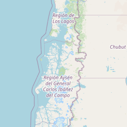
Distance Map Between Castro and Parana
Castro, Puerto Montt, Chile ↔ Parana, Argentina = 1039 miles = 1671 km.


How far is it between Castro and Paraná
Castro is located in Chile with (-42.4721,-73.7732) coordinates and Parana is located in Argentina with (-31.732,-60.5238) coordinates. The calculated flying distance from Castro to Parana is equal to 1039 miles which is equal to 1671 km.
If you want to go by car, the driving distance between Castro and Parana is 2275.53 km. If you ride your car with an average speed of 112 kilometers/hour (70 miles/h), travel time will be 20 hours 19 minutes. Please check the avg. speed travel time table on the right for various options.
Difference between fly and go by a car is 605 km.
| City/Place | Latitude and Longitude | GPS Coordinates |
|---|---|---|
| Castro | -42.4721, -73.7732 | 42° 28´ 19.5600'' S 73° 46´ 23.4840'' W |
| Parana | -31.732, -60.5238 | 31° 43´ 55.0920'' S 60° 31´ 25.6800'' W |
Estimated Travel Time Between Castro and Paraná
| Average Speed | Travel Time |
|---|---|
| 30 mph (48 km/h) | 47 hours 24 minutes |
| 40 mph (64 km/h) | 35 hours 33 minutes |
| 50 mph (80 km/h) | 28 hours 26 minutes |
| 60 mph (97 km/h) | 23 hours 27 minutes |
| 70 mph (112 km/h) | 20 hours 19 minutes |
| 75 mph (120 km/h) | 18 hours 57 minutes |
Related Distances from Castro
| Cities | Distance |
|---|---|
| Castro 2 to Rio Gallegos | 2085 km |
| Castro 2 to Ushuaia | 2658 km |
| Castro 2 to Santa Fe De La Vera Cruz | 2186 km |
| Castro 2 to Santiago Del Estero | 2471 km |
| Castro 2 to Mendoza | 1557 km |
Related Distances to Parana
| Cities | Distance |
|---|---|
| Santiago to Parana | 1298 km |
| Puerto Montt to Parana | 2061 km |
| Coihaique to Parana | 2474 km |
| Valdivia to Parana | 2021 km |
| Rio Bueno to Parana | 1989 km |