Distance from Caxias do Sul to Rawson
Distance between Caxias do Sul and Rawson is 2001 kilometers (1244 miles).
Driving distance from Caxias do Sul to Rawson is 2818 kilometers (1751 miles).
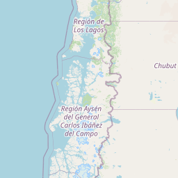
Distance Map Between Caxias do Sul and Rawson
Caxias do Sul, Porto Alegre, Brazil ↔ Rawson, Argentina = 1244 miles = 2001 km.


How far is it between Caxias do Sul and Rawson
Caxias do Sul is located in Brazil with (-29.1681,-51.1794) coordinates and Rawson is located in Argentina with (-43.3002,-65.1023) coordinates. The calculated flying distance from Caxias do Sul to Rawson is equal to 1244 miles which is equal to 2001 km.
If you want to go by car, the driving distance between Caxias do Sul and Rawson is 2817.74 km. If you ride your car with an average speed of 112 kilometers/hour (70 miles/h), travel time will be 25 hours 09 minutes. Please check the avg. speed travel time table on the right for various options.
Difference between fly and go by a car is 817 km.
| City/Place | Latitude and Longitude | GPS Coordinates |
|---|---|---|
| Caxias do Sul | -29.1681, -51.1794 | 29° 10´ 5.0160'' S 51° 10´ 45.9840'' W |
| Rawson | -43.3002, -65.1023 | 43° 18´ 0.5760'' S 65° 6´ 8.2080'' W |
Estimated Travel Time Between Caxias do Sul and Rawson
| Average Speed | Travel Time |
|---|---|
| 30 mph (48 km/h) | 58 hours 42 minutes |
| 40 mph (64 km/h) | 44 hours 01 minutes |
| 50 mph (80 km/h) | 35 hours 13 minutes |
| 60 mph (97 km/h) | 29 hours 02 minutes |
| 70 mph (112 km/h) | 25 hours 09 minutes |
| 75 mph (120 km/h) | 23 hours 28 minutes |
Related Distances from Caxias do Sul
| Cities | Distance |
|---|---|
| Caxias Do Sul to Albardon | 2215 km |
| Caxias Do Sul to Caucete | 2184 km |
| Caxias Do Sul to Tres Arroyos | 1939 km |
| Caxias Do Sul to General Roca | 2461 km |
| Caxias Do Sul to Catriel | 2399 km |
Related Distances to Rawson
| Cities | Distance |
|---|---|
| Santa Maria to Rawson | 2480 km |
| Caxias Do Sul to Rawson | 2818 km |
| Novo Hamburgo to Rawson | 2698 km |
| Sao Leopoldo to Rawson | 2682 km |
| Viamao to Rawson | 2697 km |