Distance from Cergy-Pontoise to Trappes
Distance between Cergy-Pontoise and Trappes is 30 kilometers (18 miles).
Driving distance from Cergy-Pontoise to Trappes is 39 kilometers (24 miles).
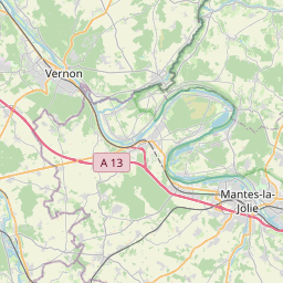
Distance Map Between Cergy-Pontoise and Trappes
Cergy-Pontoise, Paris, France ↔ Trappes, Paris, France = 18 miles = 30 km.


How far is it between Cergy-Pontoise and Trappes
Cergy-Pontoise is located in France with (49.0389,2.0781) coordinates and Trappes is located in France with (48.7741,2.0178) coordinates. The calculated flying distance from Cergy-Pontoise to Trappes is equal to 18 miles which is equal to 30 km.
If you want to go by car, the driving distance between Cergy-Pontoise and Trappes is 38.53 km. If you ride your car with an average speed of 112 kilometers/hour (70 miles/h), travel time will be 00 hours 20 minutes. Please check the avg. speed travel time table on the right for various options.
Difference between fly and go by a car is 9 km.
| City/Place | Latitude and Longitude | GPS Coordinates |
|---|---|---|
| Cergy-Pontoise | 49.0389, 2.0781 | 49° 2´ 20.1840'' N 2° 4´ 40.9800'' E |
| Trappes | 48.7741, 2.0178 | 48° 46´ 26.8680'' N 2° 1´ 4.1160'' E |
Estimated Travel Time Between Cergy-Pontoise and Trappes
| Average Speed | Travel Time |
|---|---|
| 30 mph (48 km/h) | 00 hours 48 minutes |
| 40 mph (64 km/h) | 00 hours 36 minutes |
| 50 mph (80 km/h) | 00 hours 28 minutes |
| 60 mph (97 km/h) | 00 hours 23 minutes |
| 70 mph (112 km/h) | 00 hours 20 minutes |
| 75 mph (120 km/h) | 00 hours 19 minutes |
Related Distances from Cergy-Pontoise
| Cities | Distance |
|---|---|
| Cergy Pontoise to Aulnay Sous Bois | 40 km |
| Cergy Pontoise to Elancourt | 38 km |
| Cergy Pontoise to Soisy Sous Montmorency | 23 km |
| Cergy Pontoise to Le Plessis Trevise | 55 km |
| Cergy Pontoise to Evry | 75 km |
Related Distances to Trappes
| Cities | Distance |
|---|---|
| Les Mureaux to Trappes | 34 km |
| Cergy Pontoise to Trappes | 39 km |
| Courbevoie to Trappes | 30 km |
| Stains to Trappes | 44 km |
| Saint Quentin En Yvelines to Trappes | 1 km |