Distance from Cham to Landshut
Distance between Cham and Landshut is 85 kilometers (53 miles).
Driving distance from Cham to Landshut is 111 kilometers (69 miles).
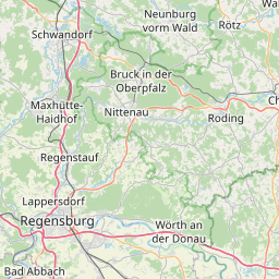
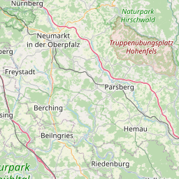
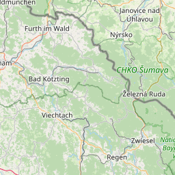
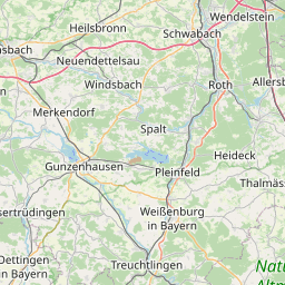
Distance Map Between Cham and Landshut
Cham, Munich, Germany ↔ Landshut, Munich, Germany = 53 miles = 85 km.


How far is it between Cham and Landshut
Cham is located in Germany with (49.2257,12.655) coordinates and Landshut is located in Germany with (48.5296,12.1618) coordinates. The calculated flying distance from Cham to Landshut is equal to 53 miles which is equal to 85 km.
If you want to go by car, the driving distance between Cham and Landshut is 110.55 km. If you ride your car with an average speed of 112 kilometers/hour (70 miles/h), travel time will be 00 hours 59 minutes. Please check the avg. speed travel time table on the right for various options.
Difference between fly and go by a car is 26 km.
| City/Place | Latitude and Longitude | GPS Coordinates |
|---|---|---|
| Cham | 49.2257, 12.655 | 49° 13´ 32.3400'' N 12° 39´ 18.0360'' E |
| Landshut | 48.5296, 12.1618 | 48° 31´ 46.5960'' N 12° 9´ 42.4440'' E |
Estimated Travel Time Between Cham and Landshut
| Average Speed | Travel Time |
|---|---|
| 30 mph (48 km/h) | 02 hours 18 minutes |
| 40 mph (64 km/h) | 01 hours 43 minutes |
| 50 mph (80 km/h) | 01 hours 22 minutes |
| 60 mph (97 km/h) | 01 hours 08 minutes |
| 70 mph (112 km/h) | 00 hours 59 minutes |
| 75 mph (120 km/h) | 00 hours 55 minutes |
Related Distances from Cham
| Cities | Distance |
|---|---|
| Cham to Deggendorf | 69 km |
| Cham to Regensburg | 60 km |
| Cham to Schwandorf In Bayern | 50 km |
| Cham to Passau | 116 km |
| Cham to Nuernberg | 137 km |
Related Distances to Landshut
| Cities | Distance |
|---|---|
| Augsburg to Landshut | 124 km |
| Ingolstadt to Landshut | 82 km |
| Landsberg Am Lech to Landshut | 123 km |
| Kempten Allgaeu to Landshut | 193 km |
| Altdorf to Landshut | 141 km |