Distance from Cheltenham to Hove
Distance between Cheltenham and Hove is 178 kilometers (111 miles).
Driving distance from Cheltenham to Hove is 253 kilometers (157 miles).
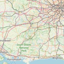
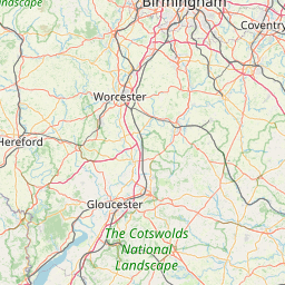
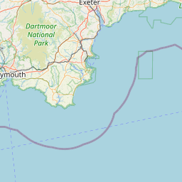
Distance Map Between Cheltenham and Hove
Cheltenham, London, United Kingdom ↔ Hove, London, United Kingdom = 111 miles = 178 km.


How far is it between Cheltenham and Hove
Cheltenham is located in United Kingdom with (51.9,-2.0833) coordinates and Hove is located in United Kingdom with (50.8309,-0.1672) coordinates. The calculated flying distance from Cheltenham to Hove is equal to 111 miles which is equal to 178 km.
If you want to go by car, the driving distance between Cheltenham and Hove is 252.66 km. If you ride your car with an average speed of 112 kilometers/hour (70 miles/h), travel time will be 02 hours 15 minutes. Please check the avg. speed travel time table on the right for various options.
Difference between fly and go by a car is 75 km.
| City/Place | Latitude and Longitude | GPS Coordinates |
|---|---|---|
| Cheltenham | 51.9, -2.0833 | 51° 53´ 60.0000'' N 2° 4´ 59.9880'' W |
| Hove | 50.8309, -0.1672 | 50° 49´ 51.1680'' N 0° 10´ 1.9200'' W |
Estimated Travel Time Between Cheltenham and Hove
| Average Speed | Travel Time |
|---|---|
| 30 mph (48 km/h) | 05 hours 15 minutes |
| 40 mph (64 km/h) | 03 hours 56 minutes |
| 50 mph (80 km/h) | 03 hours 09 minutes |
| 60 mph (97 km/h) | 02 hours 36 minutes |
| 70 mph (112 km/h) | 02 hours 15 minutes |
| 75 mph (120 km/h) | 02 hours 06 minutes |
Related Distances from Cheltenham
| Cities | Distance |
|---|---|
| Cheltenham to Chesham | 130 km |
| Cheltenham to Cheshunt | 174 km |
| Cheltenham to Chessington | 187 km |
| Cheltenham to Chester | 193 km |
| Cheltenham to Chester Le Street | 399 km |
| Cheltenham to Chesterfield | 203 km |
| Cheltenham to Chichester | 195 km |
| Cheltenham to Chippenham | 63 km |
| Cheltenham to Chipping Sodbury | 55 km |
| Cheltenham to Chislehurst | 241 km |
Related Distances to Hove
| Cities | Distance |
|---|---|
| Chelmsford to Hove | 135 km |
| Exeter to Hove | 277 km |
| Bournemouth to Hove | 161 km |
| Basingstoke to Hove | 137 km |
| Bristol to Hove | 266 km |
| High Wycombe to Hove | 133 km |
| Birmingham to Hove | 286 km |
| Eastbourne to Hove | 43 km |
| Bexley to Hove | 99 km |
| Gloucester to Hove | 258 km |