Distance from Chengde to Nangong
Distance between Chengde and Nangong is 459 kilometers (285 miles).
Driving distance from Chengde to Nangong is 567 kilometers (352 miles).
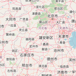
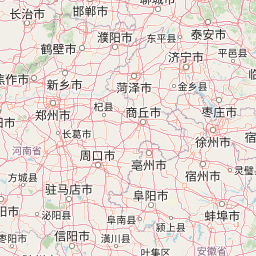
Distance Map Between Chengde and Nangong
Chengde, Shijiazhuang, China ↔ Nangong, Shijiazhuang, China = 285 miles = 459 km.


How far is it between Chengde and Nangong
Chengde is located in China with (40.9725,117.9361) coordinates and Nangong is located in China with (37.3581,115.3744) coordinates. The calculated flying distance from Chengde to Nangong is equal to 285 miles which is equal to 459 km.
If you want to go by car, the driving distance between Chengde and Nangong is 566.5 km. If you ride your car with an average speed of 112 kilometers/hour (70 miles/h), travel time will be 05 hours 03 minutes. Please check the avg. speed travel time table on the right for various options.
Difference between fly and go by a car is 108 km.
| City/Place | Latitude and Longitude | GPS Coordinates |
|---|---|---|
| Chengde | 40.9725, 117.9361 | 40° 58´ 21.0000'' N 117° 56´ 9.9960'' E |
| Nangong | 37.3581, 115.3744 | 37° 21´ 29.0160'' N 115° 22´ 27.9840'' E |
Estimated Travel Time Between Chengde and Nangong
| Average Speed | Travel Time |
|---|---|
| 30 mph (48 km/h) | 11 hours 48 minutes |
| 40 mph (64 km/h) | 08 hours 51 minutes |
| 50 mph (80 km/h) | 07 hours 04 minutes |
| 60 mph (97 km/h) | 05 hours 50 minutes |
| 70 mph (112 km/h) | 05 hours 03 minutes |
| 75 mph (120 km/h) | 04 hours 43 minutes |
Related Distances from Chengde
| Cities | Distance |
|---|---|
| Chengde to Zhangjiakou | 388 km |
| Chengde to Qinhuangdao | 222 km |
| Chengde to Handan | 689 km |
| Chengde to Baoding | 386 km |
| Chengde to Tangshan | 192 km |
Related Distances to Nangong
| Cities | Distance |
|---|---|
| Langfang to Nangong | 319 km |
| Linxi to Nangong | 471 km |
| Tianchang to Nangong | 164 km |
| Dingzhou to Nangong | 176 km |
| Xuanhua to Nangong | 497 km |