Distance from Chicago to Decatur
Distance between Chicago and Decatur is 249 kilometers (155 miles).
Driving distance from Chicago to Decatur is 289 kilometers (179 miles).
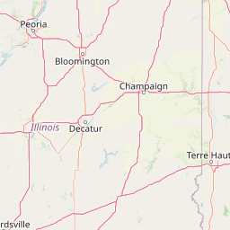
Distance Map Between Chicago and Decatur
Chicago, Springfield, United States ↔ Decatur, Springfield, United States = 155 miles = 249 km.


How far is it between Chicago and Decatur
Chicago is located in United States with (41.85,-87.6501) coordinates and Decatur is located in United States with (39.8403,-88.9548) coordinates. The calculated flying distance from Chicago to Decatur is equal to 155 miles which is equal to 249 km.
If you want to go by car, the driving distance between Chicago and Decatur is 288.74 km. If you ride your car with an average speed of 112 kilometers/hour (70 miles/h), travel time will be 02 hours 34 minutes. Please check the avg. speed travel time table on the right for various options.
Difference between fly and go by a car is 40 km.
| City/Place | Latitude and Longitude | GPS Coordinates |
|---|---|---|
| Chicago | 41.85, -87.6501 | 41° 51´ 0.1080'' N 87° 39´ 0.1800'' W |
| Decatur | 39.8403, -88.9548 | 39° 50´ 25.1160'' N 88° 57´ 17.2800'' W |
Estimated Travel Time Between Chicago and Decatur
| Average Speed | Travel Time |
|---|---|
| 30 mph (48 km/h) | 06 hours 00 minutes |
| 40 mph (64 km/h) | 04 hours 30 minutes |
| 50 mph (80 km/h) | 03 hours 36 minutes |
| 60 mph (97 km/h) | 02 hours 58 minutes |
| 70 mph (112 km/h) | 02 hours 34 minutes |
| 75 mph (120 km/h) | 02 hours 24 minutes |
Related Distances from Chicago
| Cities | Distance |
|---|---|
| Chicago to Addison | 36 km |
| Chicago to Algonquin | 72 km |
| Chicago to Alsip | 38 km |
| Chicago to Alton | 457 km |
| Chicago to Arlington Heights | 44 km |
| Chicago to Atlanta | 1153 km |
| Chicago to Aurora 2 | 69 km |
| Chicago to Austin | 1800 km |
| Chicago to Baltimore | 1128 km |
| Chicago to Bartlett 2 | 58 km |
Related Distances to Decatur
| Cities | Distance |
|---|---|
| Kennesaw to Decatur 3 | 51 km |
| Dublin 4 to Decatur 3 | 226 km |
| Sandy Springs to Decatur 3 | 29 km |
| Peachtree City to Decatur 3 | 61 km |
| Elgin to Decatur | 311 km |
| O Fallon 2 to Decatur | 181 km |
| East Point to Decatur 3 | 22 km |
| Deerfield to Decatur | 317 km |
| Tuscaloosa to Decatur 2 | 228 km |
| Johns Creek to Decatur 3 | 36 km |