Distance from Chita to Tver
Distance between Chita and Tver is 4772 kilometers (2965 miles).
Driving distance from Chita to Tver is 6402 kilometers (3978 miles).
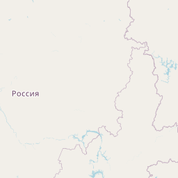
Distance Map Between Chita and Tver
Chita, Russia ↔ Tver, Russia = 2965 miles = 4772 km.


How far is it between Chita and Tver
Chita is located in Russia with (52.0317,113.5009) coordinates and Tver is located in Russia with (56.8584,35.9006) coordinates. The calculated flying distance from Chita to Tver is equal to 2965 miles which is equal to 4772 km.
If you want to go by car, the driving distance between Chita and Tver is 6401.94 km. If you ride your car with an average speed of 112 kilometers/hour (70 miles/h), travel time will be 57 hours 09 minutes. Please check the avg. speed travel time table on the right for various options.
Difference between fly and go by a car is 1630 km.
| City/Place | Latitude and Longitude | GPS Coordinates |
|---|---|---|
| Chita | 52.0317, 113.5009 | 52° 1´ 54.1560'' N 113° 30´ 3.1320'' E |
| Tver | 56.8584, 35.9006 | 56° 51´ 30.0960'' N 35° 54´ 2.0520'' E |
Estimated Travel Time Between Chita and Tver
| Average Speed | Travel Time |
|---|---|
| 30 mph (48 km/h) | 133 hours 22 minutes |
| 40 mph (64 km/h) | 100 hours 01 minutes |
| 50 mph (80 km/h) | 80 hours 01 minutes |
| 60 mph (97 km/h) | 65 hours 59 minutes |
| 70 mph (112 km/h) | 57 hours 09 minutes |
| 75 mph (120 km/h) | 53 hours 20 minutes |
Related Distances from Chita
| Cities | Distance |
|---|---|
| Chita to Moscow | 6260 km |
| Chita to Vladivostok | 2863 km |
| Chita to Irkutsk | 1100 km |
| Chita to Khabarovsk | 2105 km |
| Chita to Ulan Ude | 611 km |
Related Distances to Tver
| Cities | Distance |
|---|---|
| Moscow to Tver | 177 km |
| Saint Petersburg to Tver | 543 km |
| Samara to Tver | 1242 km |
| Stavropol to Tver | 1586 km |
| Kursk to Tver | 700 km |