Distance from Chlef to El Oued
Distance between Chlef and El Oued is 594 kilometers (369 miles).
Driving distance from Chlef to El Oued is 794 kilometers (494 miles).
Distance Map Between Chlef and El Oued
Chlef, Algeria ↔ El Oued, Algeria = 369 miles = 594 km.


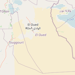

How far is it between Chlef and El Oued
Chlef is located in Algeria with (36.1653,1.3345) coordinates and El Oued is located in Algeria with (33.3561,6.8632) coordinates. The calculated flying distance from Chlef to El Oued is equal to 369 miles which is equal to 594 km.
If you want to go by car, the driving distance between Chlef and El Oued is 794.27 km. If you ride your car with an average speed of 112 kilometers/hour (70 miles/h), travel time will be 07 hours 05 minutes. Please check the avg. speed travel time table on the right for various options.
Difference between fly and go by a car is 200 km.
| City/Place | Latitude and Longitude | GPS Coordinates |
|---|---|---|
| Chlef | 36.1653, 1.3345 | 36° 9´ 54.9000'' N 1° 20´ 4.2720'' E |
| El Oued | 33.3561, 6.8632 | 33° 21´ 21.8880'' N 6° 51´ 47.4840'' E |
Estimated Travel Time Between Chlef and El Oued
| Average Speed | Travel Time |
|---|---|
| 30 mph (48 km/h) | 16 hours 32 minutes |
| 40 mph (64 km/h) | 12 hours 24 minutes |
| 50 mph (80 km/h) | 09 hours 55 minutes |
| 60 mph (97 km/h) | 08 hours 11 minutes |
| 70 mph (112 km/h) | 07 hours 05 minutes |
| 75 mph (120 km/h) | 06 hours 37 minutes |
Related Distances from Chlef
| Cities | Distance |
|---|---|
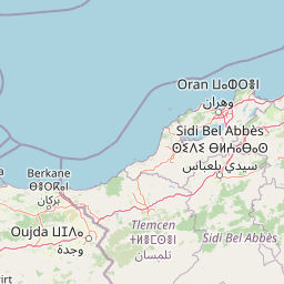
| Chlef to Oran | 216 km |
| Chlef to Tissemsilt | 112 km |
| Chlef to Tlemcen | 317 km |
| Chlef to Sidi Bel Abbes | 239 km |
| Chlef to Medea | 150 km |
Related Distances to El Oued
| Cities | Distance |
|---|---|
| Algiers to El Oued | 641 km |
| Biskra to El Oued | 226 km |
| Constantine to El Oued | 452 km |
| Adrar to El Oued | 1235 km |
| Bejaia to El Oued | 555 km |