Distance from Chopda to Taloda
Distance between Chopda and Taloda is 118 kilometers (73 miles).
Driving distance from Chopda to Taloda is 130 kilometers (81 miles).
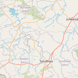
Distance Map Between Chopda and Taloda
Chopda, Mumbai, India ↔ Taloda, Mumbai, India = 73 miles = 118 km.


How far is it between Chopda and Taloda
Chopda is located in India with (21.2471,75.2982) coordinates and Taloda is located in India with (21.5606,74.2126) coordinates. The calculated flying distance from Chopda to Taloda is equal to 73 miles which is equal to 118 km.
If you want to go by car, the driving distance between Chopda and Taloda is 130.43 km. If you ride your car with an average speed of 112 kilometers/hour (70 miles/h), travel time will be 01 hours 09 minutes. Please check the avg. speed travel time table on the right for various options.
Difference between fly and go by a car is 12 km.
| City/Place | Latitude and Longitude | GPS Coordinates |
|---|---|---|
| Chopda | 21.2471, 75.2982 | 21° 14´ 49.4160'' N 75° 17´ 53.4840'' E |
| Taloda | 21.5606, 74.2126 | 21° 33´ 38.1600'' N 74° 12´ 45.2880'' E |
Estimated Travel Time Between Chopda and Taloda
| Average Speed | Travel Time |
|---|---|
| 30 mph (48 km/h) | 02 hours 43 minutes |
| 40 mph (64 km/h) | 02 hours 02 minutes |
| 50 mph (80 km/h) | 01 hours 37 minutes |
| 60 mph (97 km/h) | 01 hours 20 minutes |
| 70 mph (112 km/h) | 01 hours 09 minutes |
| 75 mph (120 km/h) | 01 hours 05 minutes |
Related Distances from Chopda
| Cities | Distance |
|---|---|
| Chopda to Jalgaon | 56 km |
| Chopda to Shirpur | 49 km |
| Chopda to Dharangaon | 31 km |
| Chopda to Erandol | 44 km |
| Chopda to Nandurbar | 123 km |
Related Distances to Taloda
| Cities | Distance |
|---|---|
| Nandurbar to Taloda | 38 km |
| Dhule to Taloda | 115 km |
| Nashik to Taloda | 231 km |
| Shirpur to Taloda | 82 km |
| Jalgaon to Taloda | 187 km |