Distance from Clement Town to Kabul
Distance between Clement Town and Kabul is 955 kilometers (594 miles).
Distance Map Between Clement Town and Kabul
Clement Town, Dehradun, India ↔ Kabul, Afghanistan = 594 miles = 955 km.


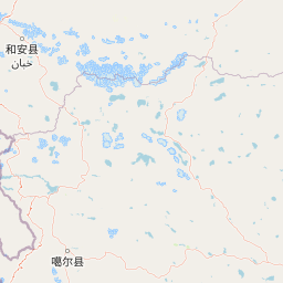


Leaflet | © OpenStreetMap
How far is it between Clement Town and Kabul
Clement Town is located in India with (30.2606,78.0119) coordinates and Kabul is located in Afghanistan with (34.5281,69.1723) coordinates. The calculated flying distance from Clement Town to Kabul is equal to 594 miles which is equal to 955 km.
| City/Place | Latitude and Longitude | GPS Coordinates |
|---|---|---|
| Clement Town | 30.2606, 78.0119 | 30° 15´ 37.9800'' N 78° 0´ 42.7680'' E |
| Kabul | 34.5281, 69.1723 | 34° 31´ 41.2680'' N 69° 10´ 20.3880'' E |
Clement Town, Dehradun, India
Related Distances from Clement Town
| Cities | Distance |
|---|---|
| Clement Town to Mussoorie | 44 km |
| Clement Town to Rishikesh | 44 km |
| Clement Town to Haridwar | 56 km |
| Clement Town to Raipur 3 | 14 km |
| Clement Town to Roorkee | 67 km |
Kabul, Afghanistan
Related Distances to Kabul
| Cities | Distance |
|---|---|
| New Delhi to Kabul | 4998 km |
| Delhi to Kabul | 4999 km |
| Srinagar to Kabul | 5778 km |
| Amritsar to Kabul | 5654 km |
| Kolkata to Kabul | 4877 km |