Distance from Colombo to Stabat
Distance between Colombo and Stabat is 2089 kilometers (1298 miles).
Driving distance from Colombo to Stabat is 8604 kilometers (5347 miles).
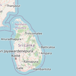
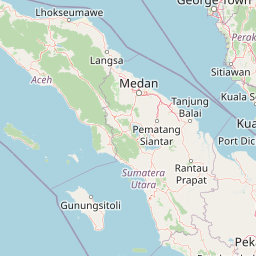
Distance Map Between Colombo and Stabat
Colombo, Sri Lanka ↔ Stabat, Medan, Indonesia = 1298 miles = 2089 km.


How far is it between Colombo and Stabat
Colombo is located in Sri Lanka with (6.9319,79.8478) coordinates and Stabat is located in Indonesia with (3.761,98.4513) coordinates. The calculated flying distance from Colombo to Stabat is equal to 1298 miles which is equal to 2089 km.
If you want to go by car, the driving distance between Colombo and Stabat is 8604.38 km. If you ride your car with an average speed of 112 kilometers/hour (70 miles/h), travel time will be 76 hours 49 minutes. Please check the avg. speed travel time table on the right for various options.
Difference between fly and go by a car is 6515 km.
| City/Place | Latitude and Longitude | GPS Coordinates |
|---|---|---|
| Colombo | 6.9319, 79.8478 | 6° 55´ 54.9840'' N 79° 50´ 52.0080'' E |
| Stabat | 3.761, 98.4513 | 3° 45´ 39.6000'' N 98° 27´ 4.6800'' E |
Estimated Travel Time Between Colombo and Stabat
| Average Speed | Travel Time |
|---|---|
| 30 mph (48 km/h) | 179 hours 15 minutes |
| 40 mph (64 km/h) | 134 hours 26 minutes |
| 50 mph (80 km/h) | 107 hours 33 minutes |
| 60 mph (97 km/h) | 88 hours 42 minutes |
| 70 mph (112 km/h) | 76 hours 49 minutes |
| 75 mph (120 km/h) | 71 hours 42 minutes |
Related Distances from Colombo
| Cities | Distance |
|---|---|
| Colombo to Medan | 8591 km |
| Colombo to Bandar | 8884 km |
| Colombo to Deli Tua | 8542 km |
| Colombo to Padangsidempuan | 8972 km |
| Colombo to Binjai | 8548 km |