Distance from Conroe to Bellaire
Distance between Conroe and Bellaire is 67 kilometers (42 miles).
Driving distance from Conroe to Bellaire is 75 kilometers (47 miles).
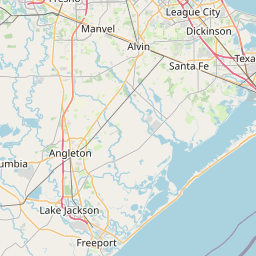
Distance Map Between Conroe and Bellaire
Conroe, Austin, United States ↔ Bellaire, Austin, United States = 42 miles = 67 km.

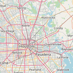
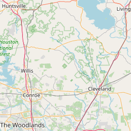


How far is it between Conroe and Bellaire
Conroe is located in United States with (30.3119,-95.4561) coordinates and Bellaire is located in United States with (29.7058,-95.4588) coordinates. The calculated flying distance from Conroe to Bellaire is equal to 42 miles which is equal to 67 km.
If you want to go by car, the driving distance between Conroe and Bellaire is 75.23 km. If you ride your car with an average speed of 112 kilometers/hour (70 miles/h), travel time will be 00 hours 40 minutes. Please check the avg. speed travel time table on the right for various options.
Difference between fly and go by a car is 8 km.
| City/Place | Latitude and Longitude | GPS Coordinates |
|---|---|---|
| Conroe | 30.3119, -95.4561 | 30° 18´ 42.7680'' N 95° 27´ 21.7800'' W |
| Bellaire | 29.7058, -95.4588 | 29° 42´ 20.8440'' N 95° 27´ 31.7880'' W |
Estimated Travel Time Between Conroe and Bellaire
| Average Speed | Travel Time |
|---|---|
| 30 mph (48 km/h) | 01 hours 34 minutes |
| 40 mph (64 km/h) | 01 hours 10 minutes |
| 50 mph (80 km/h) | 00 hours 56 minutes |
| 60 mph (97 km/h) | 00 hours 46 minutes |
| 70 mph (112 km/h) | 00 hours 40 minutes |
| 75 mph (120 km/h) | 00 hours 37 minutes |
Related Distances from Conroe
| Cities | Distance |
|---|---|
| Conroe to College Station | 103 km |
| Conroe to Brenham | 135 km |
| Conroe to Baytown | 101 km |
| Conroe to Burleson | 337 km |
| Conroe to Beaumont | 146 km |
Related Distances to Bellaire
| Cities | Distance |
|---|---|
| Houston to Bellaire | 19 km |
| The Woodlands to Bellaire | 62 km |
| Spring to Bellaire | 53 km |
| Missouri City to Bellaire | 14 km |
| Cypress 2 to Bellaire | 42 km |