Distance from Constantine to Tipasa
Distance between Constantine and Tipasa is 373 kilometers (232 miles).
Driving distance from Constantine to Tipasa is 454 kilometers (282 miles).
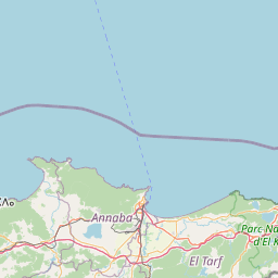
Distance Map Between Constantine and Tipasa
Constantine, Algeria ↔ Tipasa, Algeria = 232 miles = 373 km.


How far is it between Constantine and Tipasa
Constantine is located in Algeria with (36.365,6.6147) coordinates and Tipasa is located in Algeria with (36.5897,2.4475) coordinates. The calculated flying distance from Constantine to Tipasa is equal to 232 miles which is equal to 373 km.
If you want to go by car, the driving distance between Constantine and Tipasa is 454.48 km. If you ride your car with an average speed of 112 kilometers/hour (70 miles/h), travel time will be 04 hours 03 minutes. Please check the avg. speed travel time table on the right for various options.
Difference between fly and go by a car is 81 km.
| City/Place | Latitude and Longitude | GPS Coordinates |
|---|---|---|
| Constantine | 36.365, 6.6147 | 36° 21´ 54.0000'' N 6° 36´ 52.9920'' E |
| Tipasa | 36.5897, 2.4475 | 36° 35´ 22.9920'' N 2° 26´ 51.0000'' E |
Estimated Travel Time Between Constantine and Tipasa
| Average Speed | Travel Time |
|---|---|
| 30 mph (48 km/h) | 09 hours 28 minutes |
| 40 mph (64 km/h) | 07 hours 06 minutes |
| 50 mph (80 km/h) | 05 hours 40 minutes |
| 60 mph (97 km/h) | 04 hours 41 minutes |
| 70 mph (112 km/h) | 04 hours 03 minutes |
| 75 mph (120 km/h) | 03 hours 47 minutes |
Related Distances from Constantine
| Cities | Distance |
|---|---|
| Constantine to Setif | 127 km |
| Constantine to Oran | 790 km |
| Constantine to Skikda | 81 km |
| Constantine to Jijel | 132 km |
| Constantine to Tebessa | 204 km |
Related Distances to Tipasa
| Cities | Distance |
|---|---|
| Algiers to Tipasa | 63 km |
| Skikda to Tipasa | 533 km |
| Ain Temouchent to Tipasa | 441 km |
| Constantine to Tipasa | 454 km |
| Ain Defla to Tipasa | 113 km |