Distance from Contai to Gosaba
Distance between Contai and Gosaba is 117 kilometers (72 miles).
Driving distance from Contai to Gosaba is 251 kilometers (156 miles).
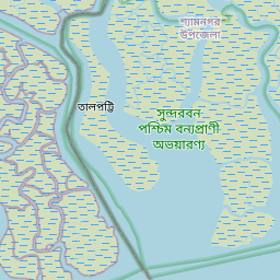
Distance Map Between Contai and Gosaba
Contai, Kolkata, India ↔ Gosaba, Kolkata, India = 72 miles = 117 km.


How far is it between Contai and Gosāba
Contai is located in India with (21.7799,87.7489) coordinates and Gosaba is located in India with (22.1655,88.8007) coordinates. The calculated flying distance from Contai to Gosaba is equal to 72 miles which is equal to 117 km.
If you want to go by car, the driving distance between Contai and Gosaba is 251.02 km. If you ride your car with an average speed of 112 kilometers/hour (70 miles/h), travel time will be 02 hours 14 minutes. Please check the avg. speed travel time table on the right for various options.
Difference between fly and go by a car is 134 km.
| City/Place | Latitude and Longitude | GPS Coordinates |
|---|---|---|
| Contai | 21.7799, 87.7489 | 21° 46´ 47.4600'' N 87° 44´ 56.1120'' E |
| Gosaba | 22.1655, 88.8007 | 22° 9´ 55.6920'' N 88° 48´ 2.5200'' E |
Estimated Travel Time Between Contai and Gosāba
| Average Speed | Travel Time |
|---|---|
| 30 mph (48 km/h) | 05 hours 13 minutes |
| 40 mph (64 km/h) | 03 hours 55 minutes |
| 50 mph (80 km/h) | 03 hours 08 minutes |
| 60 mph (97 km/h) | 02 hours 35 minutes |
| 70 mph (112 km/h) | 02 hours 14 minutes |
| 75 mph (120 km/h) | 02 hours 05 minutes |
Related Distances from Contai
| Cities | Distance |
|---|---|
| Contai to Egra | 27 km |
| Contai to Medinipur | 105 km |
| Contai to Tamluk | 65 km |
| Contai to Jhargram | 138 km |
| Contai to Kharagpur | 91 km |
Related Distances to Gosaba
| Cities | Distance |
|---|---|
| Canning to Gosaba | 31 km |
| Baruipur to Gosaba | 56 km |
| Barasat to Gosaba | 102 km |
| Bali to Gosaba | 104 km |
| Diamond Harbour to Gosaba | 120 km |