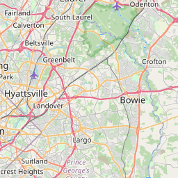
Distance from Crofton to Carney
Distance between Crofton and Carney is 46 kilometers (29 miles).
Driving distance from Crofton to Carney is 55 kilometers (34 miles).
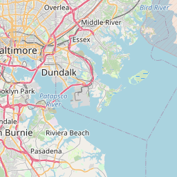
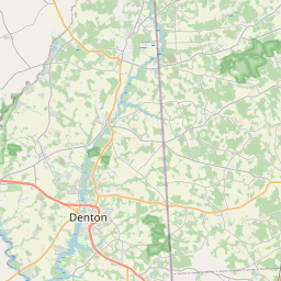
Distance Map Between Crofton and Carney
Crofton, Annapolis, United States ↔ Carney, Annapolis, United States = 29 miles = 46 km.


How far is it between Crofton and Carney
Crofton is located in United States with (39.0018,-76.6875) coordinates and Carney is located in United States with (39.3943,-76.5236) coordinates. The calculated flying distance from Crofton to Carney is equal to 29 miles which is equal to 46 km.
If you want to go by car, the driving distance between Crofton and Carney is 54.66 km. If you ride your car with an average speed of 112 kilometers/hour (70 miles/h), travel time will be 00 hours 29 minutes. Please check the avg. speed travel time table on the right for various options.
Difference between fly and go by a car is 9 km.
| City/Place | Latitude and Longitude | GPS Coordinates |
|---|---|---|
| Crofton | 39.0018, -76.6875 | 39° 0´ 6.4080'' N 76° 41´ 14.8920'' W |
| Carney | 39.3943, -76.5236 | 39° 23´ 39.3720'' N 76° 31´ 24.8880'' W |
Estimated Travel Time Between Crofton and Carney
| Average Speed | Travel Time |
|---|---|
| 30 mph (48 km/h) | 01 hours 08 minutes |
| 40 mph (64 km/h) | 00 hours 51 minutes |
| 50 mph (80 km/h) | 00 hours 40 minutes |
| 60 mph (97 km/h) | 00 hours 33 minutes |
| 70 mph (112 km/h) | 00 hours 29 minutes |
| 75 mph (120 km/h) | 00 hours 27 minutes |
Related Distances from Crofton
| Cities | Distance |
|---|---|
| Crofton to Bowie | 10 km |
| Crofton to Catonsville | 39 km |
| Crofton to Columbia 3 | 45 km |
| Crofton to Baltimore | 43 km |
| Crofton to College Park | 29 km |
Related Distances to Carney
| Cities | Distance |
|---|---|
| Dundalk to Carney | 19 km |
| Fort Washington to Carney | 106 km |
| Glen Burnie to Carney | 33 km |
| Middle River to Carney | 14 km |
| Milford Mill to Carney | 30 km |