Distance from Dabhoi to Porbandar
Distance between Dabhoi and Porbandar is 399 kilometers (248 miles).
Driving distance from Dabhoi to Porbandar is 510 kilometers (317 miles).
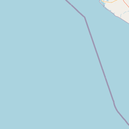
Distance Map Between Dabhoi and Porbandar
Dabhoi, Ghandinagar, India ↔ Porbandar, Ghandinagar, India = 248 miles = 399 km.


How far is it between Dabhoi and Porbandar
Dabhoi is located in India with (22.1833,73.4333) coordinates and Porbandar is located in India with (21.6422,69.6093) coordinates. The calculated flying distance from Dabhoi to Porbandar is equal to 248 miles which is equal to 399 km.
If you want to go by car, the driving distance between Dabhoi and Porbandar is 509.6 km. If you ride your car with an average speed of 112 kilometers/hour (70 miles/h), travel time will be 04 hours 33 minutes. Please check the avg. speed travel time table on the right for various options.
Difference between fly and go by a car is 111 km.
| City/Place | Latitude and Longitude | GPS Coordinates |
|---|---|---|
| Dabhoi | 22.1833, 73.4333 | 22° 10´ 59.9880'' N 73° 25´ 59.9880'' E |
| Porbandar | 21.6422, 69.6093 | 21° 38´ 31.8840'' N 69° 36´ 33.4440'' E |
Estimated Travel Time Between Dabhoi and Porbandar
| Average Speed | Travel Time |
|---|---|
| 30 mph (48 km/h) | 10 hours 37 minutes |
| 40 mph (64 km/h) | 07 hours 57 minutes |
| 50 mph (80 km/h) | 06 hours 22 minutes |
| 60 mph (97 km/h) | 05 hours 15 minutes |
| 70 mph (112 km/h) | 04 hours 33 minutes |
| 75 mph (120 km/h) | 04 hours 14 minutes |
Related Distances from Dabhoi
| Cities | Distance |
|---|---|
| Dabhoi to Vadodara | 35 km |
| Dabhoi to Rajpipla | 47 km |
| Dabhoi to Halol | 53 km |
| Dabhoi to Surat | 153 km |
| Dabhoi to Godhra | 91 km |
Related Distances to Porbandar
| Cities | Distance |
|---|---|
| Khambhaliya to Porbandar | 72 km |
| Mangrol to Porbandar | 82 km |
| Dwarka to Porbandar | 102 km |
| Junagadh to Porbandar | 107 km |
| Lalpur to Porbandar | 87 km |