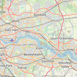
Distance from Dagenham to Harlow
Distance between Dagenham and Harlow is 25 kilometers (16 miles).
Driving distance from Dagenham to Harlow is 41 kilometers (26 miles).
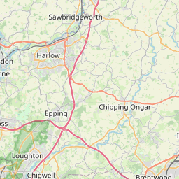
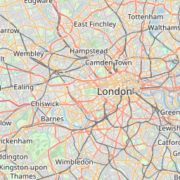
Distance Map Between Dagenham and Harlow
Dagenham, London, United Kingdom ↔ Harlow, London, United Kingdom = 16 miles = 25 km.

How far is it between Dagenham and Harlow
Dagenham is located in United Kingdom with (51.55,0.1667) coordinates and Harlow is located in United Kingdom with (51.7766,0.1116) coordinates. The calculated flying distance from Dagenham to Harlow is equal to 16 miles which is equal to 25 km.
If you want to go by car, the driving distance between Dagenham and Harlow is 41.39 km. If you ride your car with an average speed of 112 kilometers/hour (70 miles/h), travel time will be 00 hours 22 minutes. Please check the avg. speed travel time table on the right for various options.
Difference between fly and go by a car is 16 km.
| City/Place | Latitude and Longitude | GPS Coordinates |
|---|---|---|
| Dagenham | 51.55, 0.1667 | 51° 32´ 60.0000'' N 0° 10´ 0.0120'' E |
| Harlow | 51.7766, 0.1116 | 51° 46´ 35.5800'' N 0° 6´ 41.6880'' E |
Estimated Travel Time Between Dagenham and Harlow
| Average Speed | Travel Time |
|---|---|
| 30 mph (48 km/h) | 00 hours 51 minutes |
| 40 mph (64 km/h) | 00 hours 38 minutes |
| 50 mph (80 km/h) | 00 hours 31 minutes |
| 60 mph (97 km/h) | 00 hours 25 minutes |
| 70 mph (112 km/h) | 00 hours 22 minutes |
| 75 mph (120 km/h) | 00 hours 20 minutes |
Related Distances from Dagenham
| Cities | Distance |
|---|---|
| Dagenham to City Of London | 22 km |
| Dagenham to Grays | 20 km |
| Dagenham to Luton | 74 km |
| Dagenham to Southend On Sea | 52 km |
| Dagenham to Manchester | 341 km |
Related Distances to Harlow
| Cities | Distance |
|---|---|
| Chelmsford to Harlow | 32 km |
| Birmingham to Harlow | 208 km |
| Cambridge to Harlow | 64 km |
| Basildon to Harlow | 44 km |
| Bedford to Harlow | 74 km |