Distance from Dahegam to Keshod
Distance between Dahegam and Keshod is 336 kilometers (209 miles).
Driving distance from Dahegam to Keshod is 395 kilometers (245 miles).
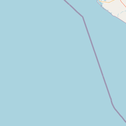
Distance Map Between Dahegam and Keshod
Dahegam, Ghandinagar, India ↔ Keshod, Ghandinagar, India = 209 miles = 336 km.


How far is it between Dahegām and Keshod
Dahegam is located in India with (23.169,72.8216) coordinates and Keshod is located in India with (21.3033,70.2486) coordinates. The calculated flying distance from Dahegam to Keshod is equal to 209 miles which is equal to 336 km.
If you want to go by car, the driving distance between Dahegam and Keshod is 394.82 km. If you ride your car with an average speed of 112 kilometers/hour (70 miles/h), travel time will be 03 hours 31 minutes. Please check the avg. speed travel time table on the right for various options.
Difference between fly and go by a car is 59 km.
| City/Place | Latitude and Longitude | GPS Coordinates |
|---|---|---|
| Dahegam | 23.169, 72.8216 | 23° 10´ 8.5080'' N 72° 49´ 17.7960'' E |
| Keshod | 21.3033, 70.2486 | 21° 18´ 11.8080'' N 70° 14´ 54.9960'' E |
Estimated Travel Time Between Dahegām and Keshod
| Average Speed | Travel Time |
|---|---|
| 30 mph (48 km/h) | 08 hours 13 minutes |
| 40 mph (64 km/h) | 06 hours 10 minutes |
| 50 mph (80 km/h) | 04 hours 56 minutes |
| 60 mph (97 km/h) | 04 hours 04 minutes |
| 70 mph (112 km/h) | 03 hours 31 minutes |
| 75 mph (120 km/h) | 03 hours 17 minutes |
Related Distances from Dahegam
| Cities | Distance |
|---|---|
| Dahegam to Vadodara | 128 km |
| Dahegam to Kapadvanj | 40 km |
| Dahegam to Modasa | 72 km |
| Dahegam to Surat | 278 km |
| Dahegam to Dwarka | 480 km |
Related Distances to Keshod
| Cities | Distance |
|---|---|
| Junagadh to Keshod | 37 km |
| Ahmedabad to Keshod | 356 km |
| Dwarka to Keshod | 200 km |
| Jetpur to Keshod | 70 km |
| Jamnagar to Keshod | 173 km |