Distance from Dammam to Beirut
Distance between Dammam and Beirut is 1628 kilometers (1012 miles).
Driving distance from Dammam to Beirut is 2070 kilometers (1287 miles).
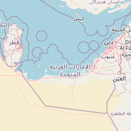
Distance Map Between Dammam and Beirut
Dammam, Saudi Arabia ↔ Beirut, Lebanon = 1012 miles = 1628 km.


How far is it between Dammam and Beirut
Dammam is located in Saudi Arabia with (26.4344,50.1033) coordinates and Beirut is located in Lebanon with (33.8889,35.4944) coordinates. The calculated flying distance from Dammam to Beirut is equal to 1012 miles which is equal to 1628 km.
If you want to go by car, the driving distance between Dammam and Beirut is 2070.49 km. If you ride your car with an average speed of 112 kilometers/hour (70 miles/h), travel time will be 18 hours 29 minutes. Please check the avg. speed travel time table on the right for various options.
Difference between fly and go by a car is 442 km.
| City/Place | Latitude and Longitude | GPS Coordinates |
|---|---|---|
| Dammam | 26.4344, 50.1033 | 26° 26´ 3.9120'' N 50° 6´ 11.7360'' E |
| Beirut | 33.8889, 35.4944 | 33° 53´ 20.1840'' N 35° 29´ 39.9120'' E |
Estimated Travel Time Between Dammam and Beirut
| Average Speed | Travel Time |
|---|---|
| 30 mph (48 km/h) | 43 hours 08 minutes |
| 40 mph (64 km/h) | 32 hours 21 minutes |
| 50 mph (80 km/h) | 25 hours 52 minutes |
| 60 mph (97 km/h) | 21 hours 20 minutes |
| 70 mph (112 km/h) | 18 hours 29 minutes |
| 75 mph (120 km/h) | 17 hours 15 minutes |
Related Distances to Beirut
| Cities | Distance |
|---|---|
| Riyadh to Beirut | 1695 km |
| Jeddah to Beirut | 2446 km |
| Dammam to Beirut | 2070 km |
| Mecca to Beirut | 2469 km |
| Tabuk to Beirut | 1652 km |