Distance from Dandeli to Hubli
Distance between Dandeli and Hubli is 56 kilometers (35 miles).
Driving distance from Dandeli to Hubli is 74 kilometers (46 miles).
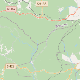
Distance Map Between Dandeli and Hubli
Dandeli, Bangalore, India ↔ Hubli, Bangalore, India = 35 miles = 56 km.


How far is it between Dandeli and Hubli
Dandeli is located in India with (15.2667,74.6167) coordinates and Hubli is located in India with (15.3478,75.1338) coordinates. The calculated flying distance from Dandeli to Hubli is equal to 35 miles which is equal to 56 km.
If you want to go by car, the driving distance between Dandeli and Hubli is 73.82 km. If you ride your car with an average speed of 112 kilometers/hour (70 miles/h), travel time will be 00 hours 39 minutes. Please check the avg. speed travel time table on the right for various options.
Difference between fly and go by a car is 18 km.
| City/Place | Latitude and Longitude | GPS Coordinates |
|---|---|---|
| Dandeli | 15.2667, 74.6167 | 15° 16´ 0.0120'' N 74° 37´ 0.0120'' E |
| Hubli | 15.3478, 75.1338 | 15° 20´ 51.9360'' N 75° 8´ 1.6080'' E |
Estimated Travel Time Between Dandeli and Hubli
| Average Speed | Travel Time |
|---|---|
| 30 mph (48 km/h) | 01 hours 32 minutes |
| 40 mph (64 km/h) | 01 hours 09 minutes |
| 50 mph (80 km/h) | 00 hours 55 minutes |
| 60 mph (97 km/h) | 00 hours 45 minutes |
| 70 mph (112 km/h) | 00 hours 39 minutes |
| 75 mph (120 km/h) | 00 hours 36 minutes |
Related Distances from Dandeli
| Cities | Distance |
|---|---|
| Dandeli to Haliyal | 24 km |
| Dandeli to Yellapur | 64 km |
| Dandeli to Mundgod | 83 km |
| Dandeli to Saundatti | 96 km |
| Dandeli to Gokarna | 135 km |
Related Distances to Hubli
| Cities | Distance |
|---|---|
| Hiriyur to Hubli | 248 km |
| Haliyal to Hubli | 51 km |
| Belgaum to Hubli | 105 km |
| Honnali to Hubli | 153 km |
| Haveri to Hubli | 75 km |