Distance from Darnah to Alexandria
Distance between Darnah and Alexandria is 711 kilometers (442 miles).
Driving distance from Darnah to Alexandria is 846 kilometers (526 miles).
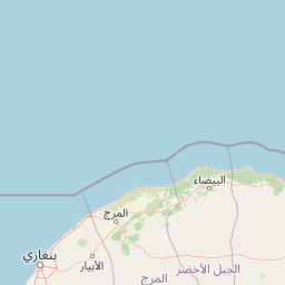
Distance Map Between Darnah and Alexandria
Darnah, Libya ↔ Alexandria, Egypt = 442 miles = 711 km.


How far is it between Darnah and Alexandria
Darnah is located in Libya with (32.767,22.6367) coordinates and Alexandria is located in Egypt with (31.2156,29.9553) coordinates. The calculated flying distance from Darnah to Alexandria is equal to 442 miles which is equal to 711 km.
If you want to go by car, the driving distance between Darnah and Alexandria is 846.39 km. If you ride your car with an average speed of 112 kilometers/hour (70 miles/h), travel time will be 07 hours 33 minutes. Please check the avg. speed travel time table on the right for various options.
Difference between fly and go by a car is 135 km.
| City/Place | Latitude and Longitude | GPS Coordinates |
|---|---|---|
| Darnah | 32.767, 22.6367 | 32° 46´ 1.3440'' N 22° 38´ 12.0840'' E |
| Alexandria | 31.2156, 29.9553 | 31° 12´ 56.3040'' N 29° 57´ 18.9720'' E |
Estimated Travel Time Between Darnah and Alexandria
| Average Speed | Travel Time |
|---|---|
| 30 mph (48 km/h) | 17 hours 37 minutes |
| 40 mph (64 km/h) | 13 hours 13 minutes |
| 50 mph (80 km/h) | 10 hours 34 minutes |
| 60 mph (97 km/h) | 08 hours 43 minutes |
| 70 mph (112 km/h) | 07 hours 33 minutes |
| 75 mph (120 km/h) | 07 hours 03 minutes |
Related Distances from Darnah
| Cities | Distance |
|---|---|
| Darnah to Alexandria | 846 km |
| Darnah to Cairo | 995 km |
| Darnah to Al Jizah | 1002 km |
Related Distances to Alexandria
| Cities | Distance |
|---|---|
| Benghazi to Alexandria | 1131 km |
| Tobruk to Alexandria | 677 km |
| Tripoli to Alexandria | 1882 km |
| Darnah to Alexandria | 846 km |
| Gharyan to Alexandria | 1933 km |